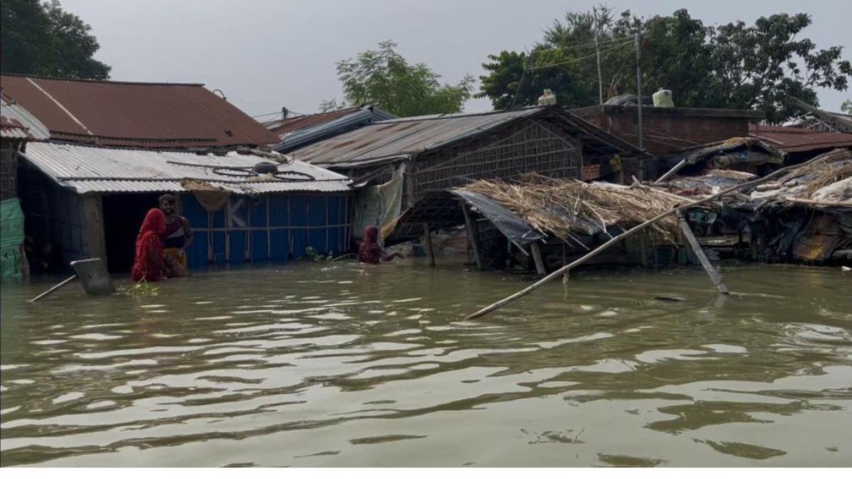
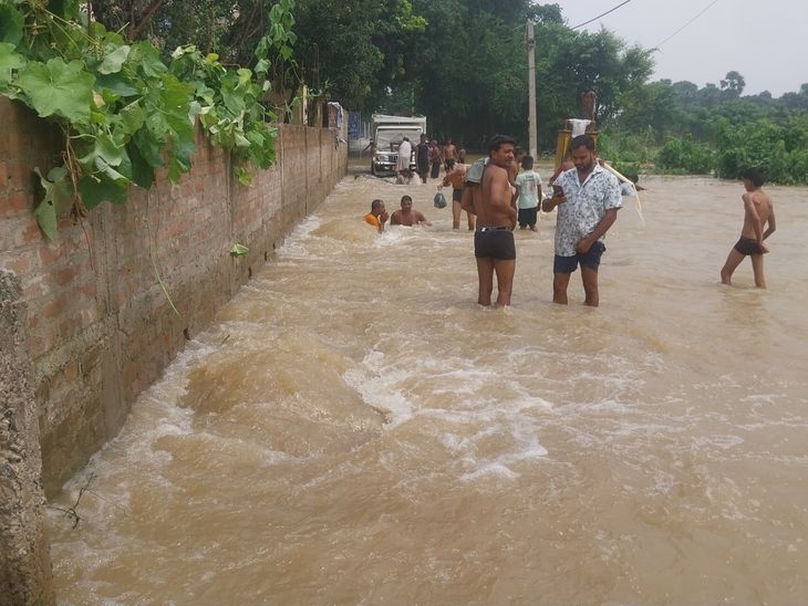
Heavy rainfall has triggered massive flooding across 15 districts in Bihar, impacting over 49 lakh people. Major rivers including the Ganga and Kosi are flowing well above danger marks.
- Over 49.36 lakh people are affected across 15 districts in Bihar.
- Major rivers like the Ganga, Kosi, and Gandak are flowing above danger levels.
- 27 SDRF teams and 10 NDRF teams are actively deployed for rescue.
- September rainfall is 13% above the seasonal normal.
A massive flood crisis has gripped Bihar, affecting more than 49 lakh people across 15 districts as of Monday, September 14, 2026. Continuous heavy rainfall over the past few days, combined with excessive water discharge from rivers flowing from Nepal, has caused multiple river systems to breach their danger marks, inundating vast stretches of farmland and residential areas.
Critical River Levels and Rainfall Data
According to the local weather office, Bihar has recorded 111.7 mm of rainfall in September so far, which is approximately 13% above the normal average. The Ganga River at Sultanganj in Bhagalpur was recorded at 36.21 metres, standing 1.71 metres above the danger level. Other critical rivers, including the Kosi, Budhi Gandak, Punpun, Bagmati, and Ghaghara, are also flowing significantly above their safety thresholds.
Why This Matters
BozokMedia analysis shows that the recurring nature of these floods poses a systemic threat to Bihar's socio-economic stability. The inundation of 15 districts not only disrupts immediate lives but also cripples the agricultural supply chain, leading to long-term economic distress for the state's rural population.
The unprecedented rise in river levels due to catchment area rainfall in Nepal necessitates a more robust trans-boundary water management strategy.
The state administration has mobilized significant resources to manage the crisis. Currently, 1,260 community kitchens and 13 relief camps are operational, providing essential food, shelter, and medical care to approximately 11,060 displaced individuals. To bolster rescue operations, the government has deployed 27 teams from the State Disaster Response Force (SDRF) and 10 teams from the National Disaster Response Force (NDRF).
Historical Background
Bihar has long been vulnerable to catastrophic flooding, particularly due to the unpredictable nature of the Kosi River, often referred to as the 'Sorrow of Bihar.' Historically, the shifting course of the Kosi and the seasonal overflow of the Ganga have caused massive displacement and loss of life, making flood mitigation a permanent challenge for state planners.
| River Name | Current Status |
|---|---|
| Ganga (Sultanganj) | 1.71m above danger level |
| Kosi (Baltara/Kursela) | Flowing above danger mark |
| Gandak (Valmiki Nagar) | Rising discharge (90,600 cusecs) |
| Bagmati | Above danger level |
Frequently Asked Questions
Question 1: Which districts are most severely impacted by the floods?
Answer: The most affected districts include Patna, Bhagalpur, Saran, Vaishali, Begusarai, Munger, Katihar, and Araria.
Question 2: How is the government assisting the affected population?
Answer: The government is operating over 1,200 community kitchens and relief camps, supported by NDRF and SDRF rescue teams.