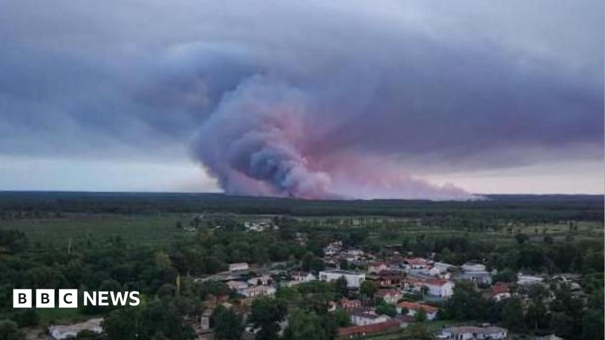
Wildfires in France's Gironde region have spawned massive pyrocumulonimbus clouds, turning the blaze into a volatile fire‑storm. These fire‑generated thunderstorms spread embers, gusty winds and lightning, making containment far more challenging.
Key Takeaways
- Pyrocumulonimbus clouds form when intense heat from wildfires creates towering thunderstorm clouds.
- These clouds unleash strong winds, ember showers and lightning, accelerating fire spread.
- Climate change is expected to increase the frequency of such extreme fire‑weather events.
What Is a Pyrocumulonimbus?
Scientists label these phenomena "fire‑generated thunderstorms" because the blaze itself supplies the energy to lift hot air, smoke, ash and water vapor high into the atmosphere. As the rising air cools, the vapor condenses into a massive cumulonimbus cloud—the same type that produces regular thunderstorms.
Current Situation in France
More than tens of thousands have been evacuated from the Bordeaux‑adjacent Gironde area as the fire creates a pyrocumulonimbus unprecedented in French records. A forecasted heatwave of up to 40 °C later this week could keep the blaze burning for weeks, if not months.
Historical Background
Similar fire‑storm clouds were documented during Australia’s 2019‑2020 “Black Summer,” sending embers up to 30 km ahead of the fire front. In 2021, California’s relentless summer fires generated mile‑high pyrocumulonimbus clouds that hovered over millions of acres.
| Year | Location | Area Burned | Pyrocloud Impact |
|---|---|---|---|
| 2020 | Australia | 11 million ha | Embers 30 km ahead |
| 2021 | California, USA | 1 million ha | Clouds 1.6 km tall |
| 2026 | France (Gironde) | Thousands of ha | First recorded in France |
Why This Matters
BozokMedia analysis shows that pyrocumulonimbus events not only jeopardize local safety but also disrupt aviation, energy grids and agricultural productivity across affected regions.
"We expect pyrocumulonimbus clouds to become more frequent and intense as global temperatures rise," says Dr. Elena Martin, climate scientist.
Frequently Asked Questions
How do pyrocumulonimbus clouds form? Intense wildfire heat forces hot air upward; as it rises, moisture condenses into a thunderstorm‑type cloud that can generate its own weather.
Will these events become more common? Climate models predict a marked rise in pyrocumulonimbus occurrences as heatwaves and droughts intensify worldwide.