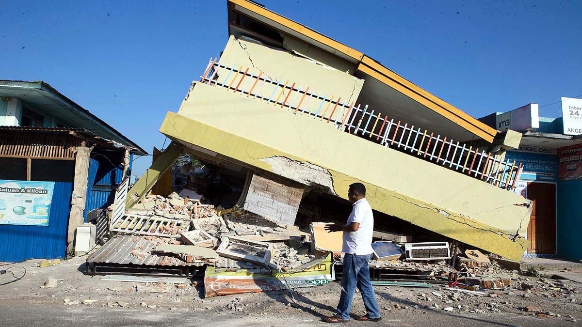
Following a devastating 7.7 magnitude earthquake on August 15, Flores Island in Indonesia has been struck by another 5.9 magnitude tremor, raising fears of continued seismic activity.
- A 5.9 magnitude earthquake struck Flores, Indonesia, on August 20.
- The initial 7.7 magnitude earthquake on August 15 has claimed over 70 lives.
- More than 3,000 aftershocks have been recorded by BMKG.
- Over 40,000 people are currently displaced in temporary shelters.
The seismic nightmare continues on Flores Island in Indonesia's East Nusa Tenggara province. Just five days after the catastrophic 7.7 magnitude earthquake on August 15, 2026, a new 5.9 magnitude tremor was recorded on Thursday, August 20. According to the European-Mediterranean Seismological Centre (EMSC) and Germany's GFZ Research Centre, the quake occurred at a shallow depth of only 10 kilometers, intensifying the impact felt across the region.
Rising Panic Amidst Continuous Aftershocks
This latest tremor follows a similar 5.9 magnitude aftershock on August 17, leaving residents in a state of constant terror. The BMKG (Meteorology, Climatology, and Geophysical Agency) reported that more than 3,000 aftershocks have been recorded as of August 19. Experts warn that this seismic sequence could persist for the next three to four weeks, although the intensity is expected to gradually diminish.
The Earth's crust is releasing energy as it seeks a new equilibrium, making vigilance essential for the coming weeks.
Scale of Destruction and Humanitarian Crisis
The primary earthquake on August 15 has left a trail of devastation. Official reports indicate that at least 70 to 73 people have died, and over 1,100 have been injured. The Manggarai and East Manggarai regencies have borne the brunt of the casualties. Approximately 12,000 homes have been damaged, with over 900 houses completely destroyed.
The humanitarian crisis is escalating as more than 40,000 people are forced to live in temporary shelters. Due to structural damage, medical professionals are forced to treat patients in tents outside hospitals. Landslides have blocked critical roads, isolating remote villages and complicating the distribution of food, water, and medicine by the National Disaster Management Agency (BNPB).
Why This Matters: BozokMedia analysis
BozokMedia analysis shows that the geological positioning of Flores makes it exceptionally vulnerable. Situated on the Pacific Ring of Fire, the region is a convergence zone for multiple tectonic plates. Shallow earthquakes, like the ones currently occurring, are particularly dangerous because the seismic energy is released closer to the surface, directly impacting human settlements and infrastructure.
| Event | Magnitude | Date |
|---|---|---|
| Main Earthquake | 7.7 | August 15, 2026 |
| Major Aftershock | 5.9 | August 17, 2026 |
| Latest Tremor | 5.9 | August 20, 2026 |
Frequently Asked Questions
Question 1: Is there an immediate threat of a tsunami?
Answer: While small tsunami waves of up to 1.61 meters were recorded during the main quake, there is no immediate large-scale tsunami warning, though residents are advised to stay alert.
Question 2: What are the main challenges for relief efforts?
Answer: Landslides have cut off road access to many villages, and the disruption of electricity and communication networks is hindering coordination.
Historical Background
The Flores region has a tragic history of seismic activity. In 1992, a massive 7.7-7.8 magnitude earthquake and subsequent tsunami killed approximately 2,500 people in this exact area. The current series of tremors serves as a grim reminder of the region's inherent geological instability.