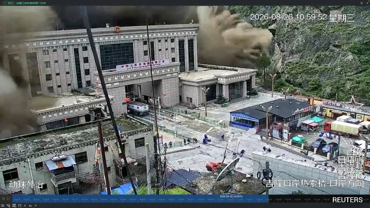
A massive barrier lake formed by flash floods near the Tibet-Nepal border poses a severe threat to downstream areas. China has issued a Level-IV alert as search operations continue for 558 missing persons.
- Flash floods at the Tibet-Nepal border have created a dangerous barrier lake.
- China's Ministry of Water Resources has issued a Level-IV alert.
- 558 people remain missing, including potential foreign tourists.
- The lake contains 2 million cubic meters of water, with inflows expected to rise.
A severe humanitarian and environmental crisis is unfolding at the Tibet-Nepal border. Following devastating flash floods in Gyirong County, a massive barrier lake has formed at the confluence of the Chhochen Khola and Purepu Tsangpo rivers. China's Ministry of Water Resources issued a Level-IV alert on Thursday night, warning that a breach in this newly formed lake could trigger catastrophic flooding in downstream regions.
The scale of the disaster is immense, with reports indicating that 558 people have gone missing since the floods struck the Gyirong Port area on August 26. Among the missing are suspected foreign tourists. The barrier lake currently holds an estimated two million cubic meters of water. With continuous rainfall forecasted, officials fear inflows could reach three million cubic meters in the coming days, significantly increasing the pressure on the natural debris dam.
Why This Matters
BozokMedia analysis shows that this event carries significant transboundary implications. Since the Chhochen Khola and Purepu Tsangpo rivers flow into Nepal as part of the Bhote Koshi river system, a breach in Tibet could result in a sudden, violent surge of water into Nepalese territory. This highlights the critical need for real-time hydrological data sharing between neighboring nations during climate-induced disasters.
The formation of a barrier lake creates a 'secondary disaster' scenario, where the initial flood is merely the precursor to a much larger, more destructive event.
In a massive technological mobilization, the China National Space Administration has deployed satellite resources to provide emergency imaging. Furthermore, Wing Loong unmanned aerial vehicles (UAVs) equipped with high-definition cameras are being used to create 3D real-scene models of the flooded terrain. This allow rescue command centers to identify priority search zones with unprecedented precision.
Rescue teams are also utilizing advanced thermal imaging equipment on drones to detect human heat signatures amidst the mud and heavy vegetation. This high-tech approach is crucial for locating the hundreds of missing individuals in the difficult terrain of the Gyirong region.
High-level government intervention is underway, with Chinese Premier Li Qiang visiting the disaster zone to assess the damage. Additionally, a directing group from the People's Liberation Army (PLA) Western Theatre Command has been dispatched to coordinate joint military-civilian rescue operations to stabilize the situation.
Frequently Asked Questions
1. What is a barrier lake and why is it dangerous?
A barrier lake is formed when debris from a landslide or flood blocks a river's flow. It is dangerous because if the debris dam fails, it releases a massive volume of water instantly, causing flash floods downstream.
2. How is technology helping the rescue efforts?
Authorities are using satellites for mapping, Wing Loong drones for 3D modeling, and thermal imaging to find survivors in mud-covered areas.