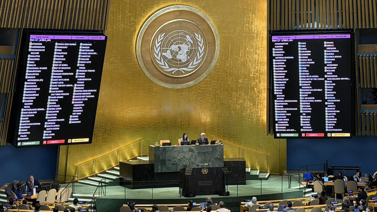
A landmark resolution aimed at improving the cartographic accuracy of continental landmasses has passed with overwhelming support. While 164 countries backed the move to represent Africa more accurately, the United States stood in opposition.
- New resolution aims for a more accurate cartographic representation of continents.
- 164 countries voted in favor of the updated mapping standards.
- The United States opposed the resolution, while six nations abstained.
In a significant move for global geography, a new resolution has been introduced to rectify the long-standing inaccuracies in how continental landmasses are depicted on world maps. The primary focus of this shift is to provide a more scientifically accurate representation of Africa, ensuring its true scale is visible to the world.
The resolution, which seeks to improve the "accuracy of cartographic representation of the world," addresses the historical distortions caused by traditional map projections. For centuries, maps have often misrepresented the size of equatorial regions, frequently making them appear smaller than they truly are in relation to northern territories.
Why This Matters
BozokMedia analysis shows that this is more than just a technical adjustment in geography; it is a profound shift in global perception. Maps serve as the foundational lens through which we view geopolitical importance. By correcting the scale of Africa, the international community is effectively acknowledging the true physical and strategic magnitude of the continent.
The reshaping of global maps is a powerful tool for correcting historical biases in how we perceive the world's power dynamics.
The voting results reflect a stark divide in global perspectives. A massive coalition of 164 countries supported the resolution, signaling a collective push for geographic equity. Conversely, the United States voted against the measure, and six other nations chose to abstain, highlighting a tension between traditional mapping standards and new accuracy requirements.
Historical Background
Most modern maps rely heavily on the Mercator Projection, a mathematical method developed in the 16th century. While excellent for navigation, it causes extreme distortion near the poles, making regions like Greenland appear as large as Africa, even though Africa is actually fourteen times larger. This resolution aims to mitigate such distortions in modern digital and physical cartography.
Frequently Asked Questions
Question 1: Why is the size of Africa being changed on maps?
Answer: The change is not creating 'new' land, but rather correcting the mathematical distortions in existing maps to show Africa's true relative size.
Question 2: Why did the US oppose this?
Answer: While specific motives vary, opposition often stems from maintaining established cartographic standards used in global navigation and education.