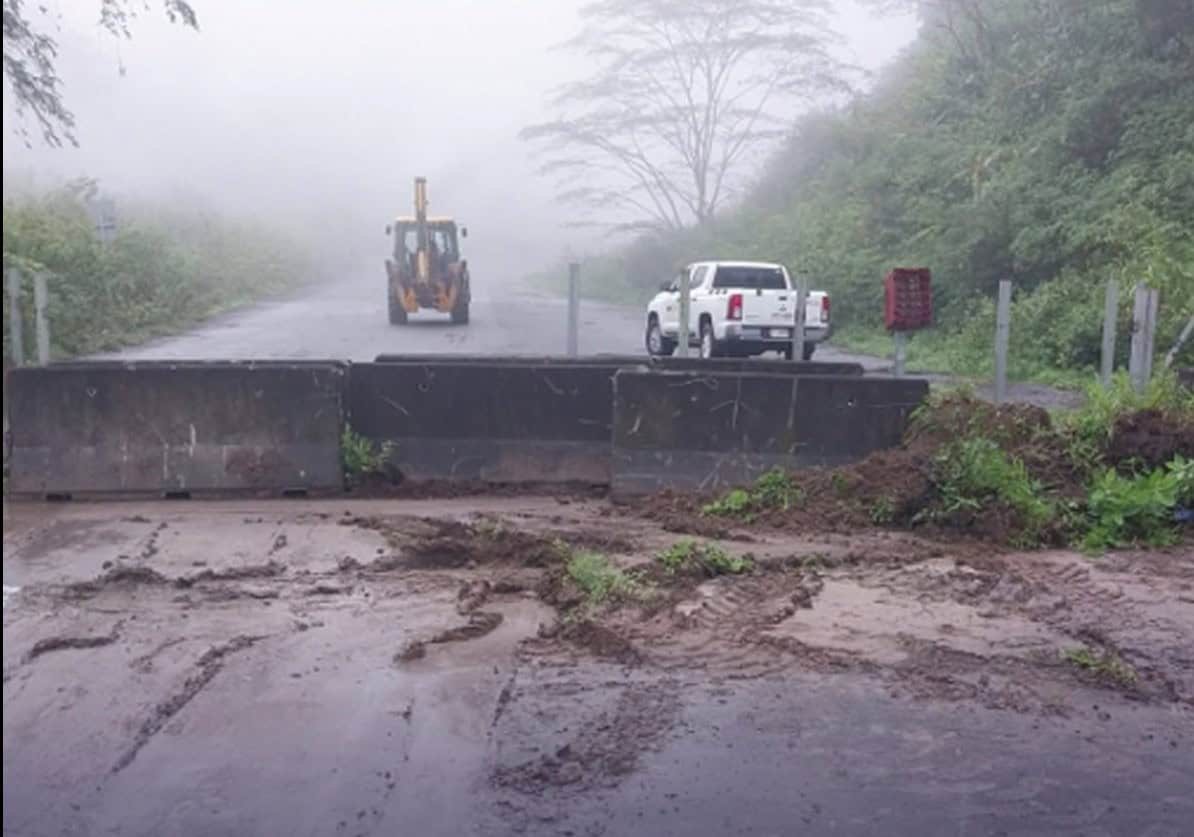
A yellow alert has been issued for Costa Rica’s northern zone, the entire Caribbean slope and the canton of Turrialba as Tropical Wave 24 brings heavy rain. Travelers and residents are urged to prepare for road closures, landslides and rapid river rise.
Key Takeaways (मुख्य बिंदु)
- Tropical Wave 24 has placed the northern zone, Caribbean slope and Turrialba under a yellow alert.
- Route 32, the main artery between San José and Limón, is repeatedly closing and reopening due to debris and landslides.
- Quick evacuation, monitoring river levels and avoiding flooded roads are essential for safety.
The Costa Rican Emergency Commission has issued a yellow alert for the northern zone, the entire Caribbean slope and the canton of Turrialba. A yellow alert is not a formality – it signals saturated soils, swollen rivers and a high risk of flash floods or landslides. Residents near rivers, steep slopes or low‑lying areas should be ready to move immediately and not wait for water to reach their doors.
The most affected corridor is Route 32, the primary link between San José and Limón. After a similar closure earlier this week, the road has been intermittently blocked by material falls in the mountainous Zurquí stretch. Drivers are advised to verify the road’s status before embarking, as closures can occur without warning when debris or crews block the lane.
If Route 32 is closed, alternatives are limited and also under strain. Route 10 (Siquirres‑Turrialba) is the usual detour but sits within the alert zone and may close again. Route 126 (Vara Blanca) is open only to light vehicles, and the Bajos de Chilamate–Vuelta de Kooper route is another option, though delays are expected on all alternatives.
Historical Background
Costa Rica has a long history of tropical disturbances causing severe flooding. The 1991 El Niño event flooded large swaths of the country, while Hurricane Iona in 2018 displaced over 100,000 people. In 2020, Tropical Storm 12 triggered similar conditions in the northern‑eastern regions. These events prompted the government to invest in a more robust national early‑warning system and improve emergency response protocols.
Why This Matters (इसके मायने क्या हैं)
According to BozokMedia analysis, the current yellow alert has immediate implications for the national economy, tourism flow, and agricultural output. Flood‑prone areas in the north see reduced crop yields, while road closures disrupt supply chains and deter visitors, directly affecting GDP growth.
For ordinary citizens, the danger lies not in the rain falling now but in the water already saturated upstream. Saturated soils quickly funnel runoff into already high rivers, creating fast‑rising water levels that can sweep away homes, vehicles and livestock. Preparedness—such as moving valuables to higher floors, keeping emergency kits ready, and never driving through moving water—can save lives.
"Once the soil reaches saturation, every additional millimetre of rain translates into rapid river rise—this is the primary driver of flash floods," said a senior climate analyst at BozokMedia.
Frequently Asked Questions (अक्सर पूछे जाने वाले प्रश्न)
Q1: Is it safe to travel on Route 32 today?
A: Only if you have verified the road’s real‑time status and are prepared for a sudden closure; conditions can change without notice.
Q2: What facilities are available at the emergency shelters?
A: Shelters provide basic food, water, first‑aid, and limited space for pets, but capacity is limited—early evacuation is recommended.