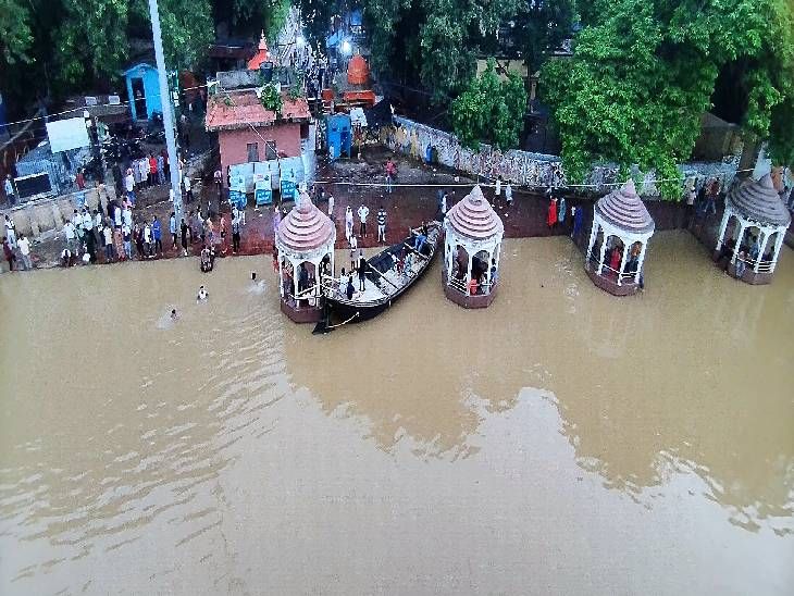
While the Ganga's water level has dipped below the danger mark at Digha Ghat, major areas like Gandhi Ghat and Hathidah remain dangerously high. Flooding continues to disrupt life in the Diara regions of Patna.
- Digha Ghat is 6 cm below the danger mark, but Gandhi Ghat is 64 cm above it.
- Connectivity to Bind Toli is severed; boat services are operating from Kurji.
- Diara regions in Danapur, Mokama, and Bakhtiyarpur face heavy crop damage.
- Orange Alert issued for five districts due to heavy rain predictions.
The water levels of the Ganga River in Patna are showing mixed signals. While there is a slight reprieve at Digha Ghat, where the water has receded to 6 cm below the danger mark, other critical locations remain in a precarious state. Gandhi Ghat is currently 64 cm above the danger line, Hathidah is 69 cm above, and Kahalgaon recorded a staggering 82 cm above the mark.
The Patna Riverfront has yet to see a significant reduction in water levels. Near Mahavir Ghat, floodwaters have spilled onto the riverside roads, causing significant disruption. The Bind Toli area has been completely cut off from the main city, forcing residents to rely on boat services operating from Kurji. Many locals have been forced to park their vehicles on the Ganga Path to avoid damage.
Why This Matters
BozokMedia analysis shows that the uneven recession of water levels creates a complex logistics challenge for disaster management teams. The isolation of Diara regions doesn't just impact travel; it cripples the local economy and food security.
The persistent high water levels at key ghats suggest that the flood risk remains acute despite the slight dip in Digha.
The impact on the rural hinterland is devastating. In the Diara regions, including Pannapur in Danapur, Nakta Diara in Sadar, and parts of Mokama and Bakhtiyarpur, residents are trapped in their homes. Schools remain closed, and there is a sharp rise in the prices of cattle fodder and essential daily commodities. While the district administration reports no large-scale migration yet, the destruction of crops is expected to be immense once the waters fully recede.
Historical Background
The annual flooding of the Ganga in Bihar is a recurring phenomenon driven by heavy monsoon rains in the upper catchment areas. Over time, changes in river morphology and increased sedimentation have made urban centers like Patna increasingly vulnerable to sudden surges in water levels.
Frequently Asked Questions
Question 1: Which areas in Patna are most affected by the flood?
Answer: Gandhi Ghat, Hathidah, Bind Toli, and the Diara regions of Mokama and Bakhtiyarpur are severely impacted.
Question 2: Is there a weather warning for Bihar?
Answer: Yes, an Orange Alert has been issued for Eastern Champaran, Madhubani, Muzaffarpur, Sheohar, and Sitamarhi due to heavy rain and lightning.