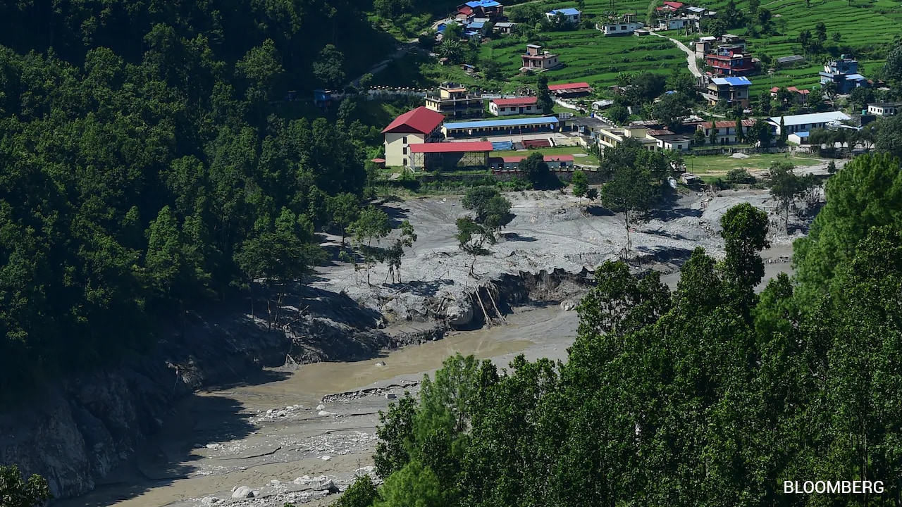
President Xi Jinping has ordered accelerated surveys of the Tibetan Plateau's glacial lakes following devastating floods in Nepal, exposing a dangerous lack of real-time data sharing between the two nations.
- President Xi Jinping ordered urgent surveys of glaciers and glacial lakes on the Tibetan Plateau.
- Recent floods in Nepal have exposed critical gaps in transboundary water data sharing.
- Climate change is accelerating glacial melt, increasing the risk of Glacial Lake Outburst Floods (GLOFs).
The catastrophic flooding in Nepal has cast a harsh spotlight on the systemic failures of international cooperation regarding environmental monitoring. In a direct response to the escalating crisis, President Xi Jinping has called for the immediate acceleration of surveys concerning glaciers and glacial lakes across the Tibetan Plateau. This region, often referred to as the 'Third Pole,' serves as the water tower for Asia, and its instability poses a direct threat to millions downstream.
For years, Nepal and other downstream nations have struggled with a lack of transparent, real-time hydrological data from China. When glacial lakes on the Tibetan Plateau breach—a phenomenon known as Glacial Lake Outburst Floods (GLOFs)—the resulting torrents tear through Nepalese villages before warnings can be issued. The current directive from Beijing suggests an admission that existing monitoring frameworks are insufficient to handle the volatility induced by global warming.
Why This Matters
BozokMedia analysis shows that this is not merely an environmental issue but a geopolitical one. The control of water data is often viewed as a strategic asset. However, as climate change accelerates the melting of the Himalayan ice caps, the 'data diplomacy' between China and Nepal must shift from strategic ambiguity to absolute transparency to prevent massive loss of life.
"The failure to share real-time glacial lake levels is a humanitarian risk that outweighs any perceived national security benefit."
Historically, the relationship between China and Nepal has been characterized by a mix of infrastructure cooperation and cautious diplomacy. While China has invested heavily in Nepal's roads and hydropower, the 'soft infrastructure' of disaster risk reduction—specifically data sharing—has lagged. The Tibetan Plateau's unique geography means that a single breach in a high-altitude lake can trigger a chain reaction of flooding across several districts in Nepal.
| Feature | Current Status | Proposed Goal |
|---|---|---|
| Survey Speed | Periodic/Slow | Accelerated/Real-time |
| Data Sharing | Limited/Delayed | Transparent/Immediate |
| Risk Mitigation | Reactive | Proactive/Predictive |
Frequently Asked Questions
What is a GLOF?
A Glacial Lake Outburst Flood occurs when the dam containing a glacial lake fails, releasing massive amounts of water and debris downstream.
Why is the Tibetan Plateau survey critical?
Because most of the rivers flowing into Nepal originate there; knowing the stability of these lakes is the only way to provide early warnings.

