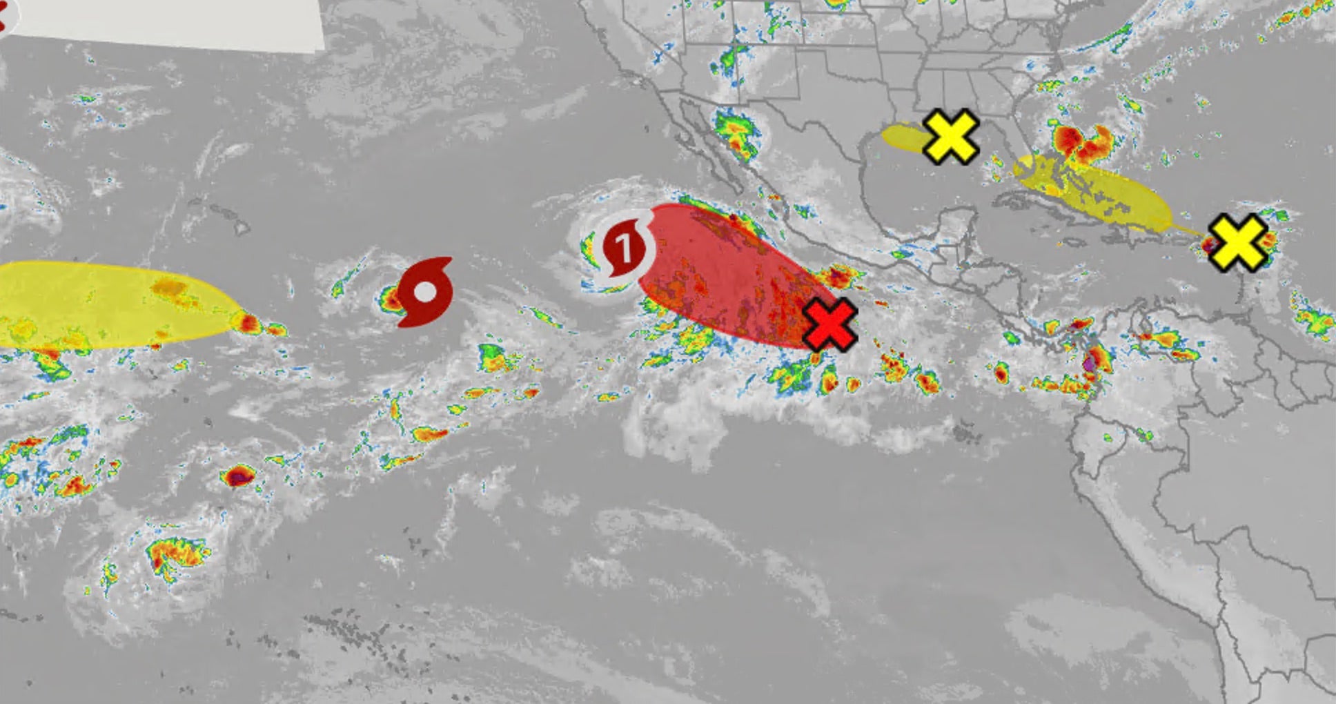
Tropical Storm Edouard has emerged in the Gulf, threatening parts of the Gulf Coast, including Houston. Meteorologists are utilizing spaghetti models and ACE metrics to track its trajectory and intensity alongside Pacific systems.
- Tropical Storm Edouard is currently threatening the Gulf Coast, with Houston identified as a high-risk area.
- Simultaneous monitoring is underway for Hurricane Karina and Tropical Storm Lowell in the Pacific.
- Wind shear and Saharan dust are acting as primary inhibitors to storm intensification.
The Atlantic basin is currently witnessing a surge in activity with the formation of Tropical Storm Edouard. Positioned in the Gulf, the system is forecast to bring significant weather impacts to the Gulf Coast. Residents of Houston and surrounding coastal regions are urged to monitor official trackers as the storm's path continues to evolve.
Meteorologists are relying on a combination of current conditions and predictive mapping to determine the storm's trajectory. Beyond Edouard, the global weather theater is active, with Hurricane Karina and Tropical Storm Lowell creating uncertainty across the Pacific. The interplay between these systems highlights a period of intense global atmospheric instability.
Why This Matters
BozokMedia analysis shows that the current season is characterized by a complex struggle between ocean heat and atmospheric resistance. While warm sea surface temperatures provide the necessary fuel for storms, high wind shear—the difference in wind speed and direction at various altitudes—acts as a natural brake, preventing many systems from reaching Category 5 status.
"The critical battle for Tropical Storm Edouard will be whether it can maintain a core structure against the encroaching dry air masses from the Sahara."
One of the most significant threats to storm development this season is the influx of dry, dust-laden air streaming from Africa's Sahara Desert. This sinking air suppresses the development of thunderstorms, which are the essential building blocks of any tropical cyclone. Maps indicate that areas covered in brown shading are currently unfavorable for storm intensification.
To quantify the season's overall intensity, experts use Accumulated Cyclone Energy (ACE). This metric accounts for both the strength and the duration of all storms in a basin. A high ACE value indicates a hyper-active season, posing prolonged risks to coastal infrastructure and insurance markets worldwide.
| Factor | Impact on Storm | Condition |
|---|---|---|
| Sea Surface Temp | Fuel Source | High Temp = Stronger Storm |
| Wind Shear | Structural Disruptor | High Shear = Weaker Storm |
| Saharan Dust | Moisture Inhibitor | Dry Air = Suppressed Growth |
Frequently Asked Questions
1. Is Houston in the direct path of Tropical Storm Edouard?
Current forecasts indicate that Edouard is likely to bring impacts to the Gulf Coast, including the Houston area, though precise landfall points remain fluid.
2. What is the role of ACE in hurricane tracking?
Accumulated Cyclone Energy (ACE) is a cumulative measure used by meteorologists to gauge the total energy produced by all tropical systems over a specific period.


