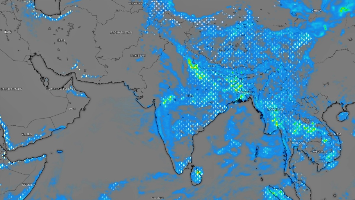
The IMD has issued a severe weather warning for North and East India as a low-pressure system over central Uttar Pradesh triggers heavy rainfall across multiple states.
- Low-pressure area active over central Uttar Pradesh.
- Heavy rainfall predicted for Bihar, West Bengal, Odisha, and NE states.
- Strong surface winds (30-40 kmph) warned for Telangana.
The India Meteorological Department (IMD) has warned of active monsoon conditions across several parts of North and East India for Tuesday, September 8. The prevailing weather pattern is being driven by a low-pressure area situated over the central regions of Uttar Pradesh, interacting with the monsoon trough and other atmospheric systems.
According to the IMD, isolated heavy rainfall is anticipated over East Madhya Pradesh, East Uttar Pradesh, Bihar, West Bengal, Odisha, and various northeastern states. This follows a period of intense precipitation in northern India, where Bareilly and parts of West Uttar Pradesh recorded exceptionally heavy rainfall exceeding 20 cm.
Why This Matters
BozokMedia analysis shows that the interaction between a low-pressure area, two western disturbances in the Himalayan region, and cyclonic circulations over Assam and Bihar creates a volatile atmospheric cocktail. Such convergences often lead to localized flooding and landslides in hilly terrains, posing a significant risk to transport networks and rural infrastructure during the closing phase of the southwest monsoon.
"The synchronization of multiple weather systems during the monsoon withdrawal phase often leads to extreme precipitation events in the Gangetic plains."
The IMD has issued a 'Yellow Warning' for several states, indicating that while the rain may be isolated, the intensity could be severe. The system, which was previously located over southwest Uttar Pradesh, has now shifted toward the center of the state, shifting the rain belt further east.
In contrast, Southern India is expected to see a dip in rainfall activity. While the peninsula remains relatively dry, Kerala is predicted to experience hot and humid conditions. Meanwhile, Telangana is on alert for strong surface winds reaching speeds of 30 to 40 kmph.
Historical Background
The southwest monsoon typically retreats from the Indian mainland by late September. However, the month of September is historically prone to 'late-season surges' where low-pressure systems over the Bay of Bengal or land-based depressions cause sudden, heavy deluges in the eastern plains, often impacting the Kharif harvest.
| Region | Weather Condition | Warning Level |
|---|---|---|
| North & East India | Heavy to Very Heavy Rain | Yellow Alert |
| Kerala | Hot and Humid | Normal |
| Telangana | Strong Winds (30-40 kmph) | Cautionary |
Frequently Asked Questions
1. Which regions are most at risk of heavy flooding?
The eastern and northeastern regions, including Bihar, West Bengal, and Odisha, are currently under the highest risk due to the shifting rain belt.
2. What is the wind speed forecast for Telangana?
The IMD expects surface winds to blow at speeds between 30 and 40 kmph in certain areas of Telangana.


