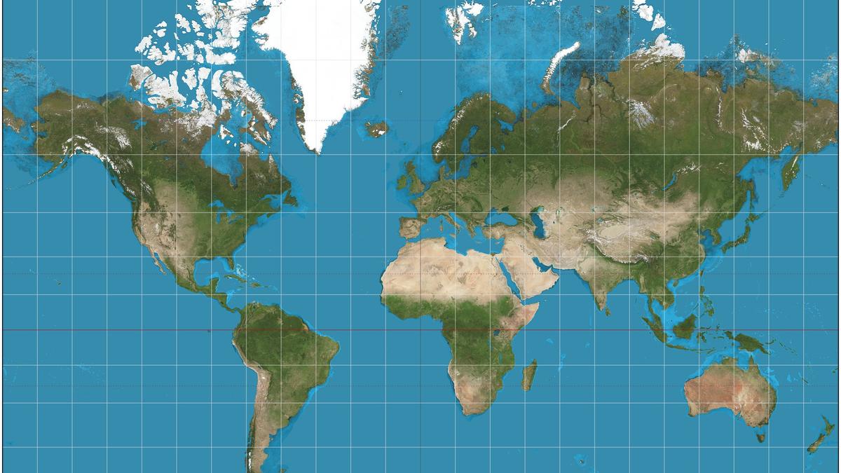
Africa is routinely depicted far smaller than its true size on most world maps, skewing geographic perception and symbolic representation. The African Union’s ‘Correct the Map’ campaign seeks to replace the Mercator projection with more equitable alternatives.
- Mercator projection shrinks Africa’s visual size
- African Union pushes for alternative map projections
- Equal-area maps can improve geopolitical representation
Historical Background
In 1569, Flemish cartographer Gerardus Mercator introduced the Mercator projection to solve a navigation problem. While it renders rhumb lines as straight, making sea routes easier to plot, it dramatically enlarges regions at high latitudes, distorting true area.
‘Correct the Map’ Campaign
The African Union (AU) has endorsed the ‘Correct the Map’ initiative, urging the replacement of the Mercator projection with alternatives such as the Equal Earth map. The AU argues that the current system has symbolically marginalized Africa for centuries while inflating Europe, North America, and Greenland.
Alternative Projections
Equal Earth preserves area, showing Africa at a size close to its actual 30 million sq km. Other equal‑area projections like Gall‑Peters and Mollweide also aim for size fairness, each with its own visual trade‑offs.
| Projection | Africa Size on Map | Greenland Size on Map |
|---|---|---|
| Mercator | ≈ 1/14 of actual size | ≈ 14× actual size |
| Equal Earth | Accurate area representation | Accurate area representation |
Why This Matters
BozokMedia analysis shows that map distortion influences educational narratives, investment decisions, and geopolitical perception, making accurate representations crucial for a balanced global outlook.
"Distorted maps shape national self‑esteem and foreign policy," says Dr. Michael Osei, African studies scholar.
Frequently Asked Questions
Q1: Why does Africa appear smaller on many maps?
A: The Mercator projection inflates high‑latitude regions, causing Africa’s area to be under‑represented.
Q2: Which alternative projections offer a fairer view?
A: Equal Earth, Gall‑Peters, and Mollweide provide more accurate area representation.