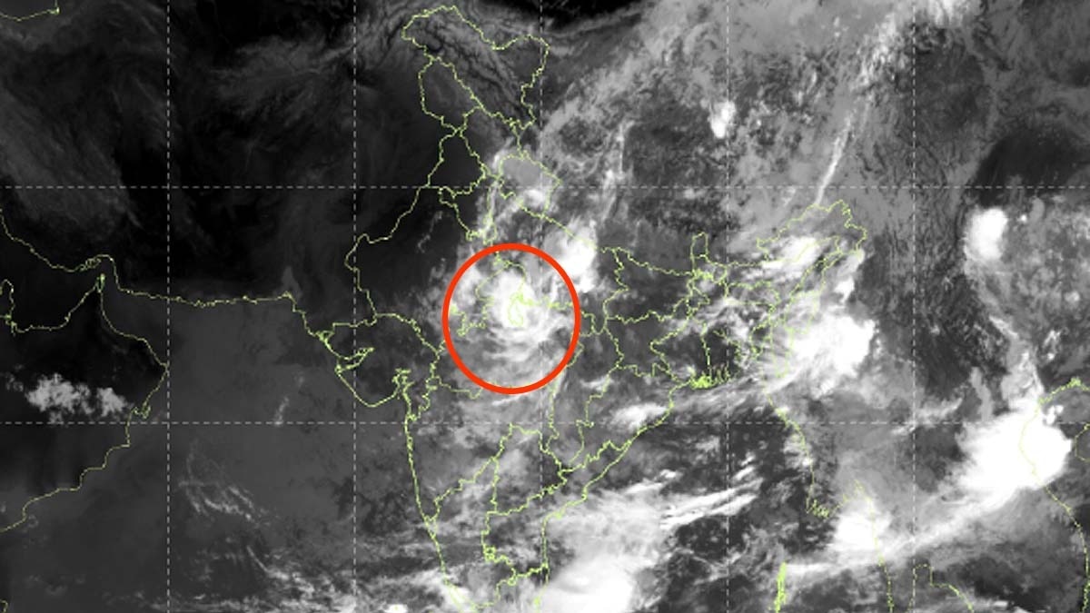
Latest thermal infrared imagery from ISRO's INSAT-3DS satellite shows a massive accumulation of monsoon clouds over Central and Eastern India, signaling intense rainfall and potential flood risks.
- INSAT-3DS satellite captured a massive deployment of monsoon clouds over Central and Eastern India.
- Heavy rainfall and thunderstorms are expected in Madhya Pradesh, Bihar, Jharkhand, and West Bengal.
- Climate change is causing 'uneven rainfall,' with floods in the East and potential droughts in the West/South.
- Delhi-NCR is likely to experience scattered showers and localized thunderstorms.
Recent thermal infrared imagery captured by the INSAT-3DS satellite and analyzed by the India Meteorological Department (IMD) has revealed a dramatic transformation in India's monsoon pattern. The satellite images depict a thick, bright sheet of dense monsoon clouds stretching across Central India, the Gangetic plains, and the eastern states.
Meteorologists indicate that these cloud formations are linked to intense convection processes. This means warm air is rising rapidly, which is a precursor to heavy downpours, lightning, and severe thunderstorms. The cloud band is particularly prominent from Madhya Pradesh through Bihar, Jharkhand, and into West Bengal and the Northeastern states.
Why This Matters
BozokMedia analysis shows that this shift in monsoon behavior is a stark indicator of shifting climatic patterns. The traditional uniformity of the Indian monsoon is being replaced by extreme regional disparities. While the eastern half of the country faces the threat of flooding and waterlogging, large parts of Western, Southern, and North-Western India may remain relatively dry.
The intensity and distribution of the monsoon are no longer uniform, posing significant challenges to regional agriculture and water management.
Weather models suggest that the first two weeks of September will be critical. Low-pressure systems are expected to trigger heavy rainfall cycles in eastern India. In districts where the soil is already saturated, this could lead to rapid flooding and significant damage to infrastructure.
For the National Capital Region (NCR), the forecast indicates localized convective activity. Residents can expect scattered showers, often occurring in the late afternoon or evening. These showers are highly localized, meaning one neighborhood might experience heavy rain while another remains dry.
| Region | Expected Weather Condition | Primary Risk |
|---|---|---|
| Central & Eastern India | Heavy Rainfall / Intense Clouds | Flooding & Waterlogging |
| Western & Southern India | Relatively Dry / Patchy Clouds | Water Scarcity / Drought |
| Delhi-NCR | Scattered Showers | Localized Traffic/Urban Flooding |
Frequently Asked Questions
1. Which states are most at risk of heavy rain?
Madhya Pradesh, Bihar, Jharkhand, and West Bengal are currently seeing the highest cloud density and rainfall potential.
2. Why is the rainfall so uneven this year?
Scientists attribute the uneven distribution to climate change and shifting monsoon wind patterns.