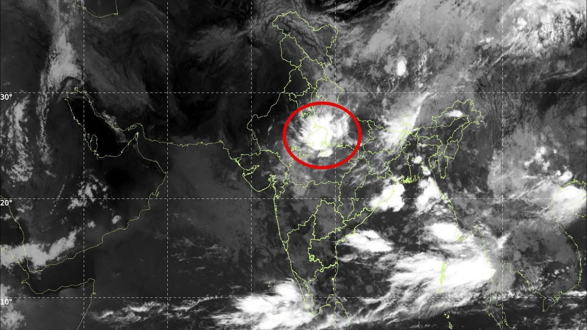
Latest satellite imagery from ISRO's INSAT-3DS reveals a powerful low-pressure system over central India, driving widespread rainfall, even as experts predict a potential monsoon withdrawal after September 10.
- ISRO's INSAT-3DS satellite has identified massive convective cloud development over central and eastern India.
- A low-pressure area has shifted from West Jharkhand towards Northeast Madhya Pradesh.
- A potential shift in jet streams after September 10 could trigger the monsoon's withdrawal.
The Indian monsoon remains in a highly active phase, as evidenced by the latest data from ISRO's INSAT-3DS weather satellite. Extensive cloud formations are currently bubbling over the central and eastern belts of India, driven by a potent low-pressure system that is sustaining significant rainfall across the region.
According to the India Meteorological Department (IMD), the low-pressure area, which was initially centered over West Jharkhand, has transitioned towards northeast Madhya Pradesh. This system is characterized by a cyclonic circulation extending up to 5.8 kilometers above mean sea level. Meteorological models suggest the system will move west-northwestward over the next 24 hours, potentially intensifying precipitation in central and northern India.
Why This Matters
BozokMedia analysis shows that these atmospheric systems act as crucial engines for the monsoon, drawing moisture deep into the subcontinent. The positioning of this low-pressure cell is critical for replenishing groundwater levels in the central belt, which is vital for the upcoming Rabi crop season.
The current convective activity is a classic sign of an active monsoon phase, but the upcoming shift in atmospheric currents could change the narrative rapidly.
Despite the current intensity, the long-term outlook suggests a transition. Forecasters indicate that after September 10, the upper-level jet stream is expected to shift southwards. This movement could introduce dry air into the northwest and central regions, leading to a noticeable decline in rainfall and potentially triggering the early stages of the southwest monsoon's withdrawal from northwestern India.
Historical Background
The withdrawal of the monsoon is a complex seasonal transition governed by the movement of the subtropical westerly jet stream. Historically, the monsoon's retreat follows a predictable pattern, but increasing climatic variability has led to more erratic withdrawal dates in recent decades.
Frequently Asked Questions
1. Will there be heavy rain in Delhi-NCR?
Widespread rain is unlikely in Delhi-NCR; however, isolated thunderstorms and moderate showers may occur in Noida, Ghaziabad, and Faridabad during the afternoon.
2. When will the monsoon officially withdraw?
While the current system is active, the official withdrawal process from northwestern India is expected to begin around mid-September.