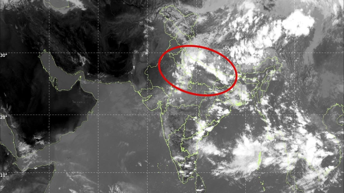
Latest INSAT-3DS satellite imagery confirms the southwest monsoon remains strong across North and Central India, with a major shift toward South India expected by mid-September.
- INSAT-3DS imagery confirms widespread cloud cover across North, Central, and East India.
- Monsoon activity is expected to persist in northern regions until mid-September.
- A significant shift toward South India is projected around September 20th.
The southwest monsoon continues to exhibit remarkable strength across vast stretches of North, Central, and East India. Recent satellite observations from the INSAT-3DS reveal extensive cloud formations and active weather systems stretching across the subcontinent, indicating that the monsoon is far from retreating.
The imagery shows dense cloud bands spanning the Himalayan region, the Indo-Gangetic plains, and central India. Convective clouds and thunderstorms are also highly active over the eastern and northeastern parts of the country, fueled by continuous moisture from the Bay of Bengal.
Why This Matters
BozokMedia analysis shows that this late-season monsoon strength is a critical factor for the kharif crop cycle. The persistence of rainfall in the northern plains provides a final boost to agriculture, while the impending shift to the south will be vital for replenishing reservoirs in the peninsular region.
The satellite data tells a clear story: the monsoon's grip over North India remains firm, but its next destination is clearly the south.
According to recent weather model projections, this active phase is likely to continue for at least another week across large parts of the country. However, a major reorganization of the monsoon circulation is expected in the second half of September.
Historical Background: Historically, the monsoon's withdrawal is a gradual process. While the retreating monsoon typically begins in the northwest in early September, atmospheric shifts can often cause prolonged spells of rain in central and northern belts, as seen in current satellite patterns.
| Region | Status (Until Mid-Sept) | Status (Post Sept 20) |
|---|---|---|
| North India | Active Rainfall/Clouds | Drier Conditions |
| South India | Moderate Activity | Increased Rainfall |
| Central India | Heavy Monsoon Grip | Gradual Decline |
Frequently Asked Questions
1. When will the rain stop in North India?
While rains will continue through mid-September, a significant reduction is expected by September 20th.
2. What is causing the monsoon to shift?
The shift is driven by the reorganization of monsoon circulation and the movement of the monsoon trough.

