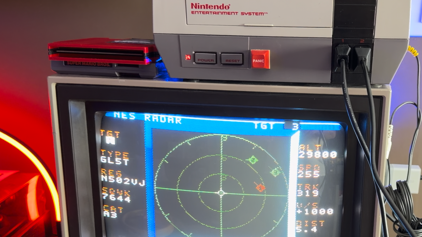
An ingenious open-source project by k6lcm has transformed the classic NES into a live air traffic visualizer using a custom serial cable and Python backend.
- Transforms a vintage NES into a live flight tracker using ICAO codes.
- Uses the second controller port as a serial interface for data transmission.
- Powered by a Python script that fetches real-time aircraft positions.
In an era of high-definition displays and cloud computing, the NES Radar project brings a refreshing blend of retro hardware and modern data. Developed by k6lcm and released as open-source under the GPL on GitHub, this project allows users to visualize current-day air traffic on a console from the 1980s.
The technical execution is particularly fascinating. While observers initially suspected the presence of modern microcontrollers like the ESP32 or PicoW hidden within the cartridge, it is actually a standard ROM cart. The connectivity is achieved through a carefully constructed cable that repurposes the NES's second controller port into a serial port, operating at 9600 baud.
Why This Matters
BozokMedia analysis shows that this project highlights the enduring flexibility of legacy architecture. By bridging the gap between modern ADS-B data APIs and 8-bit hardware, the project demonstrates that the bottleneck in retro-computing is often not the processing power, but the data ingress method. The limitation to 8 sprites on screen serves as a poignant reminder of the hardware constraints of the era.
"The brilliance of this project lies in its minimalism; it leverages existing ports to create a bridge between the 1985 gaming era and 2024 aviation data."
The workflow involves a nearby computer running a Python script, which fetches aircraft coordinates and streams them to the NES. This methodology is a spiritual successor to the c64u-radar, which performed similar feats for the Commodore 64, though the NES version required a more creative approach due to the lack of a built-in LAN port.
Frequently Asked Questions
Q1: Does the NES actually receive radio signals?
No, there is no radio or Range-Finding hardware involved. The data is fetched via the internet on a PC and sent to the NES via a cable.
Q2: Where can I find the source code for this project?
The project is open-source and available on GitHub under the GPL license.