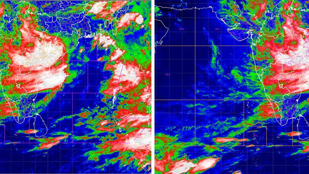
The Indian Meteorological Department reported that the deep depression is weakening and that no new vortex has formed over the Bay of Bengal or the Arabian Sea. ISRO’s satellite imagery clearly illustrates this development.
Key Takeaways
- Depression intensity has weakened
- No new vortex over Bay of Bengal or Arabian Sea
- ISRO satellite images confirm the observation
The Indian Meteorological Department reported that the deep depression is weakening and that no new vortex has formed over the Bay of Bengal or the Arabian Sea. ISRO’s satellite imagery clearly illustrates this development.
Historical Background
Historically, both the Bay of Bengal and the Arabian Sea have been breeding grounds for severe cyclones that cause extensive flooding and wind damage. The evolution and rapid weakening of depressions in these regions are critical indicators for forecasters.
Why This Matters
BozokMedia analysis shows that such meteorological shifts directly affect maritime trade, agriculture, and emergency response planning, making precise monitoring essential.
"The rapid weakening of the depression could alter the trajectory of any future cyclonic development," noted weather expert Dr. Ajay Singh.
Frequently Asked Questions
Q: Could this depression intensify again?
A: Meteorologists suggest that if sea surface temperatures remain high, re-intensification is possible.
Q: Will this change affect maritime navigation?
A: Currently, no significant risk is foreseen, but continuous monitoring is advised.