North Texas is bracing for life-threatening heat as temperatures are expected to peak at 108 degrees. Isolated thunderstorms provide little relief amid ongoing drought conditions.
- Temperatures are expected to reach 107°F on Sunday and 108°F on Monday.
- Heat index values could soar beyond 110°F due to high humidity.
- Stage 1 drought conditions remain in effect across North Texas.
- Isolated thunderstorms have provided minimal relief to central Dallas.
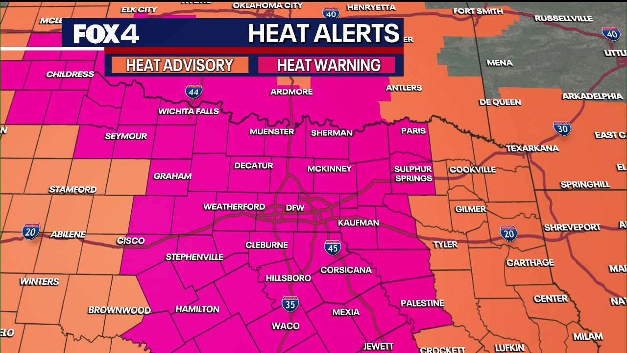
DALLAS, TX: A punishing heatwave is set to grip North Texas, bringing near-record temperatures and dangerous conditions to the region. The Dallas-Fort Worth metroplex is under an Extreme Heat Warning, with meteorologists forecasting temperatures to climb to 107 degrees Fahrenheit on Sunday and a blistering 108 degrees on Monday.
The danger is amplified by high humidity levels, which are expected to push the heat index—the measure of how hot it actually feels—past the 110-degree mark. While early morning thunderstorms were spotted in Red River, Delta, and Hopkins Counties, the coverage remains sparse, affecting only about 10% of the region. Most of central Dallas and Tarrant counties remain dry and vulnerable to the intensifying heat.
Why This Matters
BozokMedia analysis shows that the intersection of extreme heat and existing drought conditions creates a volatile environment for both public health and local infrastructure. With Stage 1 drought conditions implemented last Thursday, the meager precipitation from recent isolated showers is insufficient to recharge soil moisture or alleviate the growing water scarcity concerns in North Texas.
The combination of record-breaking heat and sustained drought poses a significant threat to regional water security and public safety.
Looking ahead, a slight reprieve is anticipated mid-week as the high-pressure system shifts. Temperatures are projected to dip toward 101 degrees by Thursday, with a modest 20% chance of rain returning to the area late in the week. However, the immediate focus remains on managing the risks associated with the upcoming peak temperatures on Sunday and Monday.
Historical Background
North Texas has frequently battled intense heat cycles, but the increasing frequency and intensity of these heatwaves have become a hallmark of recent climatic trends in the Southern United States. These events often lead to increased energy demand and significant strain on the regional power grid.
Frequently Asked Questions
1. When will the heatwave subside?
A slight cooling trend is expected by Wednesday, with temperatures dropping to around 103 degrees.
2. Is there any rain expected to help the drought?
Current rainfall is extremely limited and isolated; significant relief is not expected until later in the week.