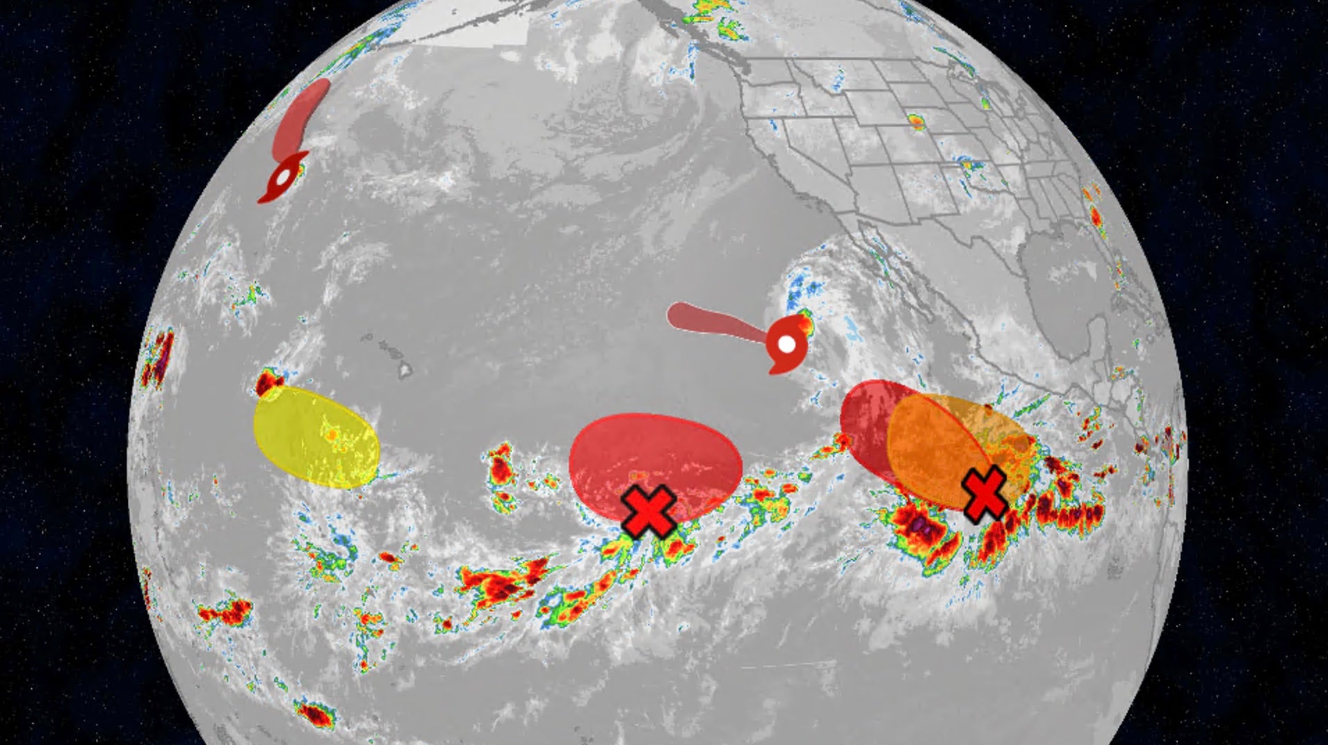
Stay updated with the 2026 hurricane season tracker covering the Pacific and Atlantic basins. Experts monitor sea surface temperatures, wind shear, and tropical systems like Lala and Iselle.
- Tropical systems 'Lala' and 'Iselle' are currently being monitored in the Pacific Basin.
- High wind shear and dry Saharan dust are acting as major deterrents to storm development.
- Accumulated Cyclone Energy (ACE) is being used to measure the overall intensity of the season.
The 2026 hurricane season is proving to be a complex period for meteorologists, with significant activity observed in both the Pacific and Atlantic basins. Satellite imagery is currently providing real-time tracking of tropical systems, most notably Lala and Iselle in the Pacific, whose forecast cones of uncertainty are being closely watched by emergency management teams.
Environmental Obstacles: Wind Shear and Dry Air
Understanding the mechanics of storm development is crucial. One of the primary inhibitors of cyclone maturation is wind shear—the variation in wind speed and direction at different altitudes. High wind shear can effectively 'decapitate' a developing storm, preventing it from organizing. Furthermore, plumes of dry, dusty air originating from the Sahara Desert frequently sweep across the Atlantic, suppressing the thunderstorm activity necessary for hurricane formation.
Why This Matters
BozokMedia analysis shows that the interplay between rising sea surface temperatures and atmospheric stability is creating highly unpredictable weather patterns. As these systems gain energy, the potential for rapid intensification increases, posing a direct threat to coastal infrastructures and lives.
The ability to accurately model wind shear and moisture levels is the thin line between a manageable storm and a catastrophic landfall.
To gauge the severity of this season, meteorologists rely on the Accumulated Cyclone Energy (ACE) metric. Unlike simple storm counts, ACE accounts for both the intensity and the duration of tropical systems, providing a more holistic view of the season's total energy output.
Frequently Asked Questions
Question 1: What is the 'Cone of Uncertainty'?
Answer: It is a graphical representation of the potential path a tropical cyclone might take, though it does not predict the exact center line.
Question 2: How does sea temperature affect hurricanes?
Answer: Warmer sea surface temperatures provide the thermal energy required to fuel and intensify tropical cyclones.
