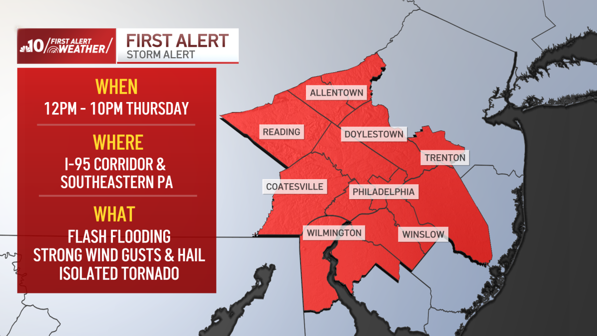
A massive storm system is battering the Philadelphia region and South Jersey, bringing dangerous flash flooding, high winds, and tornado threats. Residents are advised to take immediate precautions.
- Severe storm 'First Alert' in effect for Philadelphia and suburbs until 10 PM.
- Flash flooding reported in South Jersey with up to 3 inches of rain.
- Tornado warning issued and briefly active for Salem County, NJ.
The Philadelphia region and its surrounding suburbs are currently grappling with a severe weather emergency. On Thursday, August 27, a 'First Alert' was triggered due to the imminent threat of intense storms, heavy rainfall, and high winds. The weather system has moved through the Interstate 95 corridor, causing significant disruption to daily life.
Reports from South Jersey indicate that the impact has been particularly severe. Many neighborhoods experienced torrential downpours, with rainfall totals reaching up to three inches in a short span. This sudden deluge has led to widespread flash flooding, prompting the National Weather Service to issue a flood watch that remains in effect until 4 a.m. Friday morning.
Why This Matters
BozokMedia analysis shows that sudden-onset storm systems like this pose a critical risk to both human life and infrastructure. Rapidly rising waters can trap motorists and overwhelm local drainage systems, making even routine travel extremely hazardous during these windows of extreme weather.
The rapid escalation from heavy rain to flash flood warnings requires immediate community vigilance and preparedness.
The intensity of the storm was highlighted when a Tornado Warning was issued for Salem County, New Jersey. While the warning was eventually canceled, its issuance underscores the volatility of the atmospheric conditions currently affecting the Mid-Atlantic region.
Throughout the afternoon, multiple flash flood and severe thunderstorm warnings were activated across various Philadelphia suburbs. Emergency management officials continue to monitor the situation as the storm system moves northwest of the primary corridor.
Frequently Asked Questions
Question 1: What areas are most at risk?
Answer: The Philadelphia suburbs, areas along the Interstate 95 corridor, and parts of South Jersey are currently under high alert.
Question 2: How much rain has fallen so far?
Answer: Some areas in South Jersey have already recorded up to three inches of rainfall.
