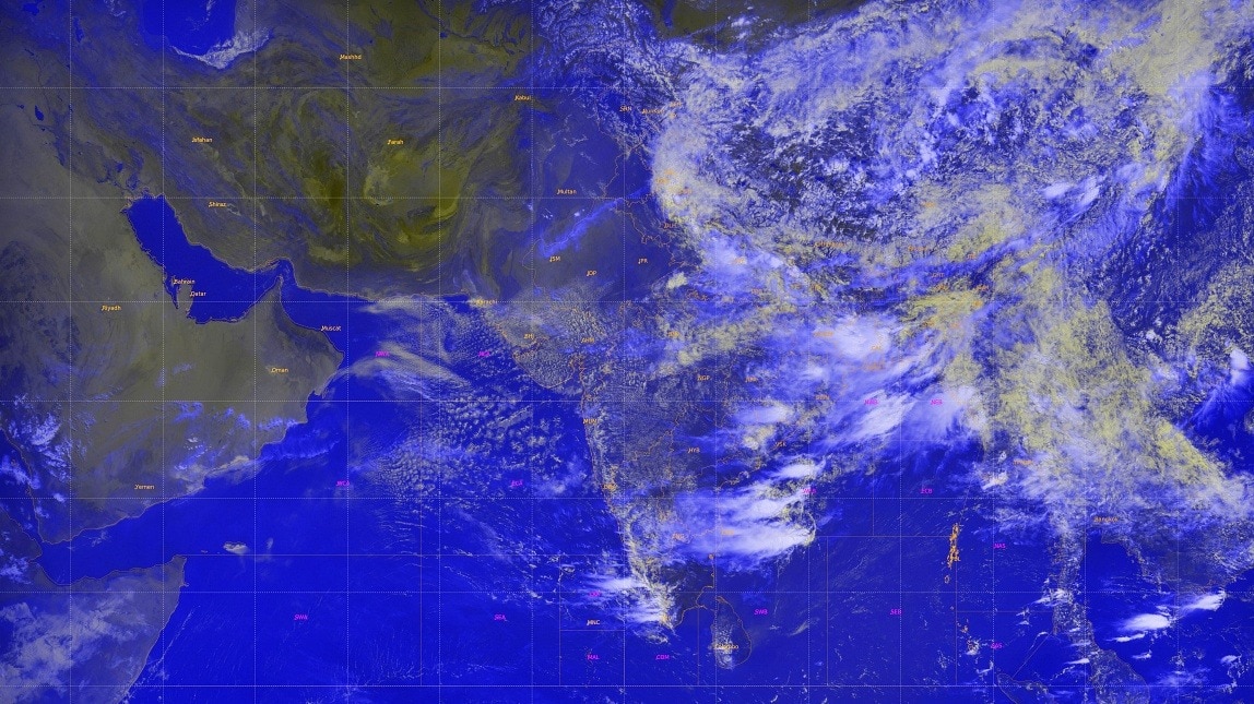
New ISRO satellite imagery shows a dense, rain‑laden cloud mass hovering over Uttarakhand, prompting the Indian Meteorological Department (IMD) to issue heavy‑rain alerts across multiple districts. The forecast raises concerns of flash floods, water‑logging and landslides in the Himalayan state.
मुख्य बिंदु (Key Takeaways)
- ISRO satellite captured a massive monsoon cloud over Uttarakhand
- IMD issued heavy‑rain alerts for several districts
- Risk of flash floods, water‑logging and landslides has escalated
Satellite observations from the Indian Space Research Organisation (ISRO) reveal a thick, rain‑bearing cloud blanket stretching across Uttarakhand and the western Himalayas. The formation signals an active monsoon pulse capable of delivering intense rain bouts, thunderstorms and lightning strikes throughout the state. In tandem, the Indian Meteorological Department (IMD) has raised alarms for heavy to very heavy rainfall on July 10, 2026.
IMD Alerts and Affected Districts
The department released an Orange Alert for Pauri Garhwal, Nainital, Udham Singh Nagar, Champawat and Bageshwar, indicating a high probability of “heavy‑to‑very‑heavy” rainfall. A Watch has also been issued for Dehradun, Tehri Garhwal, Haridwar, Uttarkashi, Rudraprayag, Chamoli, Almora and Pithoragarh, where isolated locations may experience intense rain accompanied by thunderstorms and lightning.
Potential Hazards and Local Impact
Heavy precipitation coupled with strong thunderstorms raises the specter of flash floods, rapid water‑logging and slope failures, especially in river valleys and landslide‑prone terrains. Authorities have urged residents in vulnerable zones to stay vigilant, keep emergency kits ready, and avoid non‑essential travel on mountain roads that could become treacherous.
Weather Outlook for the Next 48 Hours
IMD forecasts that the wet spell will persist into Saturday, July 11, with light‑to‑moderate rain and thunderstorms across much of Garhwal and Kumaon. However, isolated pockets of heavy rain are expected in Uttarkashi, Rudraprayag, Chamoli, Almora, Bageshwar and Pithoragarh, where intense to very intense rain spells could trigger localized flooding.
Implications for Pilgrims and Tourists
Given the ongoing Char Dham Yatra and other pilgrimage circuits, the department advises pilgrims and tourists to monitor official advisories closely and refrain from traveling through high‑risk mountain passes. Local police and disaster‑response teams have been placed on standby to expedite rescue operations if needed.
Overall, the rapid cloud development underscores how climate‑driven monsoon dynamics are amplifying weather extremes in India’s Himalayan belt. Continuous satellite monitoring and timely public warnings remain crucial tools to mitigate the humanitarian and economic toll of such natural events.