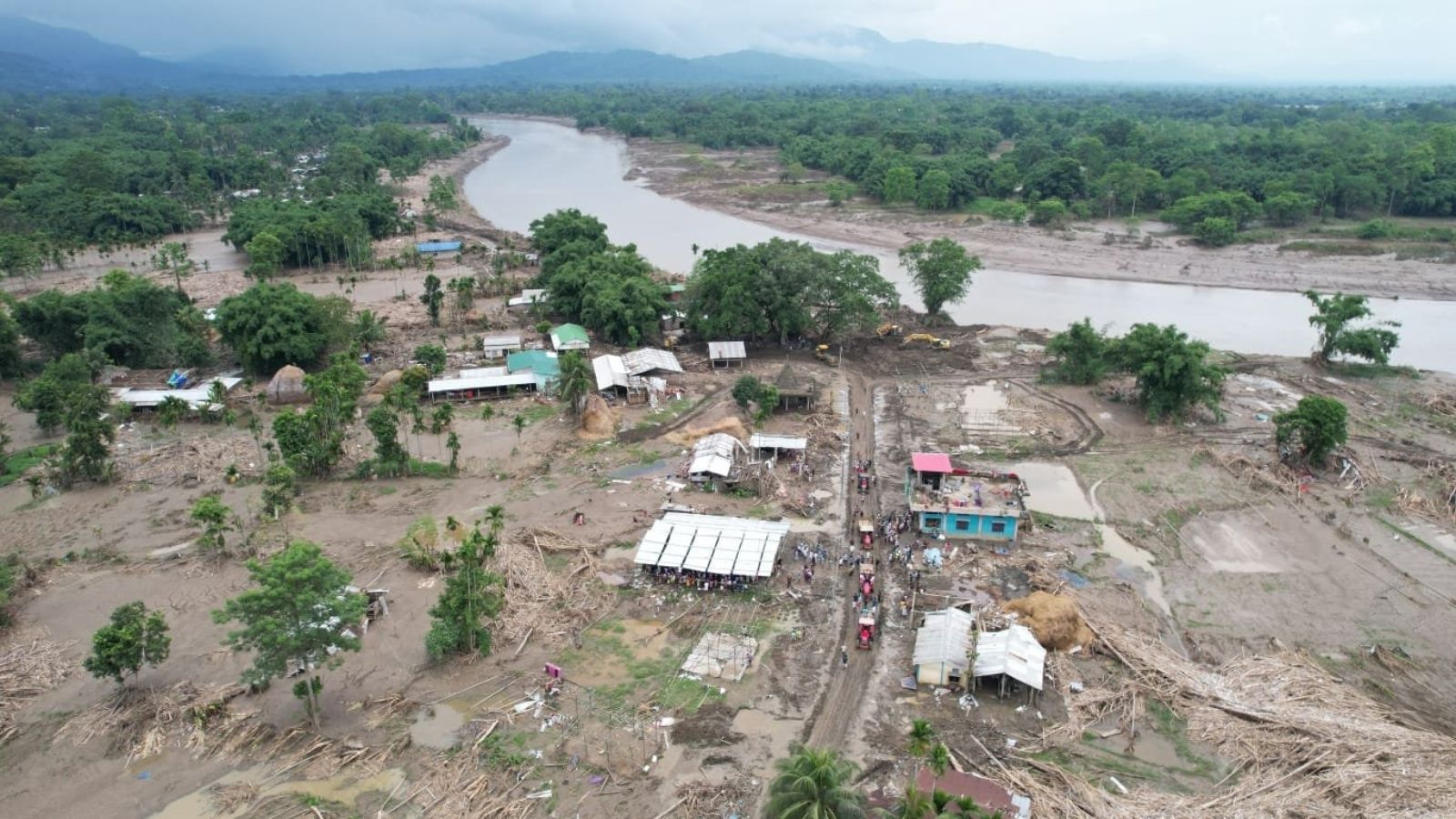
The catastrophic flooding in Upper Assam is not merely a seasonal event driven by the Brahmaputra, but a systemic failure of a broken landscape and disrupted ecology.
Key Takeaways
- Assam's flooding is driven by highland catchments in Nagaland and Arunachal Pradesh, not just the Brahmaputra.
- Decades of deforestation, mining, and intensive land use have stripped the land of its ability to absorb rainfall.
- Colonial-era shifts toward tea plantations and mineral extraction fundamentally altered the region's resilience.
- Man-made embankments have created a false sense of security while disrupting natural sediment flows.
In the third week of July, several south-bank rivers in Upper Assam rose with terrifying speed, swallowing paddy fields, livestock, and entire villages. This catastrophe is not just a seasonal misfortune; it is the culmination of nearly two centuries of environmental vulnerabilities that have quietly eroded the region's historical resilience.
The disaster pattern is unique. Upper Assam felt the brunt even before the Brahmaputra reached its peak. Heavy rains in the Naga Hills and Arunachal Pradesh unleashed sudden torrents into southern tributaries. Experts point to aggressive resource extraction—such as stone and boulder mining from riverbeds—as a primary driver that has accelerated runoff, turning rainfall into instant devastation downstream.
Why This Matters
BozokMedia analysis shows that Assam is a complex, multi-layered environmental system. Caught between the Eastern Himalayas and the Bay of Bengal, its stability relies on a delicate balance of highlands, floodplains, and shifting river channels. When this balance is disturbed by rapid land-use changes, the entire system collapses.
The vulnerability of Assam is rooted in a long history of shrinking safety margins within a once-stable monsoon landscape.
Historically, the mid-19th century marked a turning point. The expansion of colonial tea plantations, followed by coal and petroleum extraction, replaced thick forests with landscapes that could no longer hold water. This was compounded in the 20th century by a techno-bureaucratic obsession with building embankments, which interrupted natural sediment flows and encouraged settlement in high-risk lowlands.
Impact Comparison: Historical vs. Modern Landscape
| Feature | Historical Landscape | Modern Landscape |
|---|---|---|
| Vegetation | Dense Forests (High absorption) | Plantations/Mining (High runoff) |
| River Dynamics | Natural, slow-rising floods | Sudden breaches via embankments |
| Human Settlement | Distanced from main channels | Encroached on floodplains |
Frequently Asked Questions
Question 1: Are the floods in Assam purely natural disasters?
No, while the monsoon is natural, the severity is heavily influenced by human activities like mining, deforestation, and improper embankment management.
Question 2: How do the hills affect the Assam plains?
The highlands of Nagaland and Arunachal act as catchments; when they are deforested, rainwater rushes into the Assam plains much faster than it did historically.