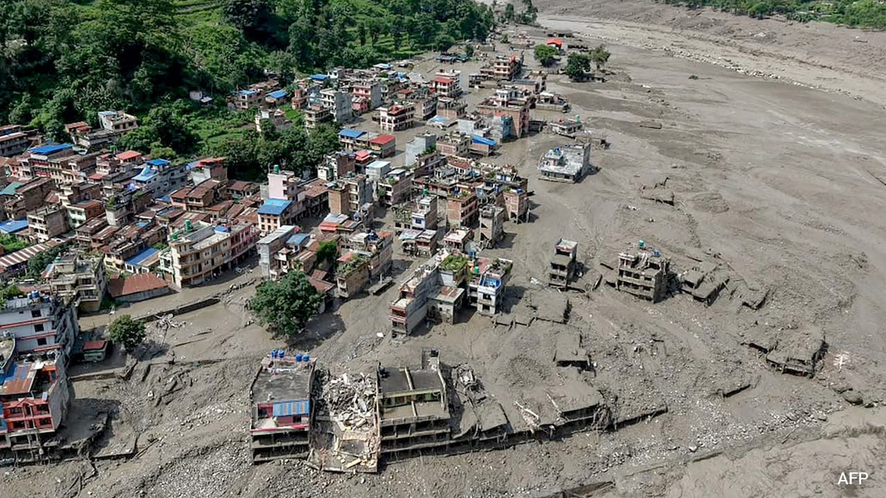
The U.S. Geological Survey (USGS) has clarified that the devastating seismic activity and subsequent floods in Nepal and Tibet were caused by a glacial collapse rather than an earthquake.
- A massive glacial collapse and debris flow caused catastrophic flooding in Nepal and Tibet.
- USGS confirmed the event was not an earthquake, despite initial reports.
- At least 160 fatalities have been confirmed, with hundreds missing.
- Satellite imagery and seismic analysis were crucial in identifying the true cause.
The scale of destruction along the Nepal-Tibet border has reached catastrophic proportions following a massive environmental event. The U.S. Geological Survey (USGS) officially reported on Thursday that the seismic activity initially mistaken for an earthquake was actually a massive glacial collapse and subsequent debris flow. This event triggered torrential waters and mud to sweep through downstream regions, causing widespread devastation.
Correcting the Seismic Narrative
In the immediate aftermath of the event on August 26, 2026, initial reports suggested a magnitude 4.4 earthquake had struck the region. However, advanced analysis of long-period seismic waves and satellite imagery provided a different story. The USGS determined that the event actually registered a magnitude 5.2 seismic signature, characteristic of a large-scale glacial failure rather than tectonic movement.
Why This Matters
BozokMedia analysis shows that the distinction between an earthquake and a glacial collapse is critical for disaster management and regional stability. As global temperatures rise, the structural integrity of Himalayan glaciers is weakening, making these 'non-seismic' events increasingly frequent and potentially more deadly than traditional earthquakes due to the immediate onset of flash floods.
The misidentification of glacial collapses as earthquakes highlights the need for more sophisticated real-time monitoring in high-altitude regions.
Nepal's Foreign Minister, Shishir Khanal, had previously speculated that an earthquake might have triggered a landslide that blocked a river. While the end result—a massive flood—was similar, the USGS findings shift the blame from tectonic shifts to the accelerating effects of glacial instability.
Historical Background
The Himalayan region is highly susceptible to Glacial Lake Outburst Floods (GLOFs). These occur when the natural dams (often made of ice or debris) holding back meltwater collapse. Over the last decade, the frequency of such events has surged, linked directly to the rapid melting of high-altitude ice reserves.
Frequently Asked Questions
1. Was there an earthquake in Nepal on August 26?
No, according to the USGS, the seismic event was caused by a glacial collapse and debris flow.
2. What caused the massive flooding?
The collapse of a glacier sent a massive torrent of water and debris downstream, causing flash floods.