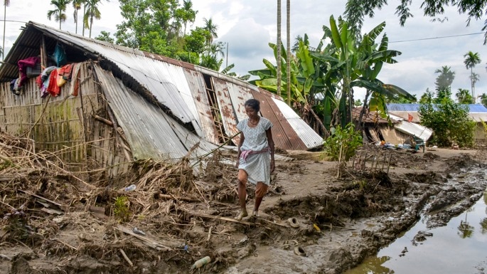
The flood crisis in Assam has escalated severely, with the death toll reaching 100 following two more casualties. Over 1.37 lakh residents across seven districts are currently battling widespread inundation, crop damage, and displacement.
Key Takeaways
- Assam's flood death toll has officially reached 100 after two fresh casualties.
- Over 1.37 lakh people are severely affected across seven major districts.
- More than 450 villages are currently submerged, destroying over 11,900 hectares of crops.
The flood situation in Assam remains extremely critical as the death toll climbed to 100 following two more reported casualties in Golaghat and Karbi Anglong districts. According to the official bulletin from the Assam State Disaster Management Authority (ASDMA), the deluge continues to wreak havoc, affecting over 1.37 lakh people across seven districts of the northeastern state.
Heavy monsoon rains have caused several major rivers, including the Dhansiri and Kushiyara, to swell and flow well above their danger levels. The rising water levels have inundated vast expanses of agricultural land, leaving 456 villages submerged and damaging approximately 11,933.46 hectares of standing crops, threatening the region's agricultural economy.
Why This Matters
BozokMedia analysis shows that the recurring nature of the Assam floods highlights a systemic vulnerability in regional infrastructure and disaster preparedness. While temporary relief camps provide immediate shelter to nearly 50,000 displaced citizens, the long-term ecological and economic toll on rural communities demands a shift from reactive relief to proactive, climate-resilient engineering solutions.
"The management of the Brahmaputra basin requires a coordinated, transboundary approach that combines modern hydrological modeling with localized community-based resilience strategies."
District-Wise Flood Impact Comparison
| District | Affected Population | Impact Severity |
|---|---|---|
| Golaghat | ~70,000 | Critical / Worst Hit |
| Sivasagar | ~40,000 | Severe |
| Jorhat | ~16,000 | Moderate to High |
Historical Background
Assam has historically been highly prone to devastating annual floods due to its unique geographical location in the Brahmaputra and Barak river valleys. The Brahmaputra River, which originates in Tibet, carries massive volumes of water and silt as it enters India. During the monsoon season, the combination of high rainfall, seismic activity, and unstable riverbanks leads to severe channel instability and routine flooding, making it one of the most complex hydrological challenges in South Asia.
Frequently Asked Questions
Q1: Which districts are currently the worst affected by the Assam floods?
A1: Golaghat is the worst-affected district with nearly 70,000 people hit, followed by Sivasagar with approximately 40,000 and Jorhat with over 16,000 affected residents.
Q2: What measures are being taken to assist the displaced population?
A2: The state administration has set up 125 relief camps and distribution centers across six districts, currently sheltering and providing essential aid to over 49,000 displaced people.