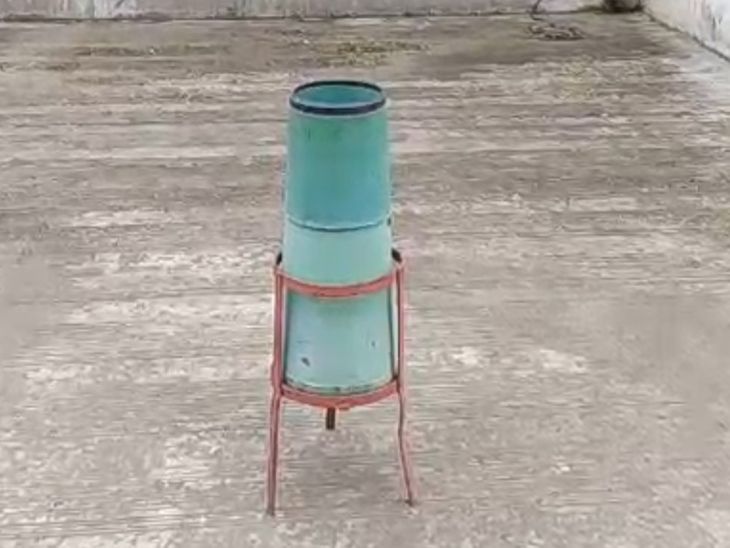
To combat urban flooding and ensure accurate rainfall data, the Surat Municipal Corporation (SMC) has installed two new rain gauge meters in the Vesu and Bhestan areas.
- SMC has installed two new rain gauge meters in Vesu and Bhestan.
- The total number of rainfall monitoring centers in Surat has increased from 8 to 10.
- The move aims to address the discrepancy in rainfall patterns caused by city expansion.
- The municipality plans to upgrade the entire system to digital meters in the near future.
Following the heavy downpours and subsequent waterlogging crises experienced in Surat during July, the Surat Municipal Corporation (SMC) has taken a proactive step to enhance its weather monitoring capabilities. By installing new rain gauge meters, the civic body aims to make the rainfall measurement system more accurate and capable of handling the city's evolving geographical needs.
Since the expansion of the municipal limits, the geographical footprint of Surat has grown significantly. This expansion has led to noticeable variations in rainfall patterns across different zones. For instance, the Sarthana zone recorded nearly 1.5 times more rainfall than other areas during the current monsoon season. Previously, the city relied on only 8 fire stations across various zones, including Randar, Udhna-A, Varachha, and others, to monitor rainfall.
Bridging the Data Gap in Vesu and Bhestan
A major challenge identified by the authorities was the significant disparity in rainfall readings between the Vesu and Majura areas. Vesu, being a high-risk area for waterlogging, required its own dedicated monitoring equipment to provide localized data. Furthermore, the Sachin-Kankapur area in Udhna-B lacked adequate facilities, making it difficult to assess the true extent of rainfall in that sector.
Accurate rainfall data is the cornerstone of effective urban flood management and long-term infrastructural planning.
Why This Matters: BozokMedia Analysis
BozokMedia analysis shows that this move by the SMC is a critical response to the challenges of rapid urbanization. As Surat expands, a 'one-size-fits-all' approach to rainfall monitoring is no longer viable. By increasing the number of monitoring stations from 8 to 10, the corporation is moving toward a decentralized and more granular data collection model, which is essential for managing localized flash floods in developing zones like Bhestan.
Currently, these gauges are operated manually. However, to stay ahead of climate unpredictability, the municipal administration is actively considering an upgrade to digital rain gauges. This transition will allow for real-time data transmission, enabling faster emergency responses during extreme weather events.
Historical Background
Historically, Surat's topography and its proximity to major water bodies have made it susceptible to seasonal flooding. As the city has transformed into a massive industrial and residential hub, the pressure on the existing drainage systems has intensified, making precise meteorological data a necessity rather than a luxury.
Frequently Asked Questions
1. How many rain gauge centers does Surat have now?
With the addition of the new meters, the total number of rain gauge centers in Surat has increased to 10.
2. Which areas will benefit most from these new installations?
The Vesu and Bhestan (covering Sachin-Kankapur) areas will benefit most from more accurate localized rainfall data.
