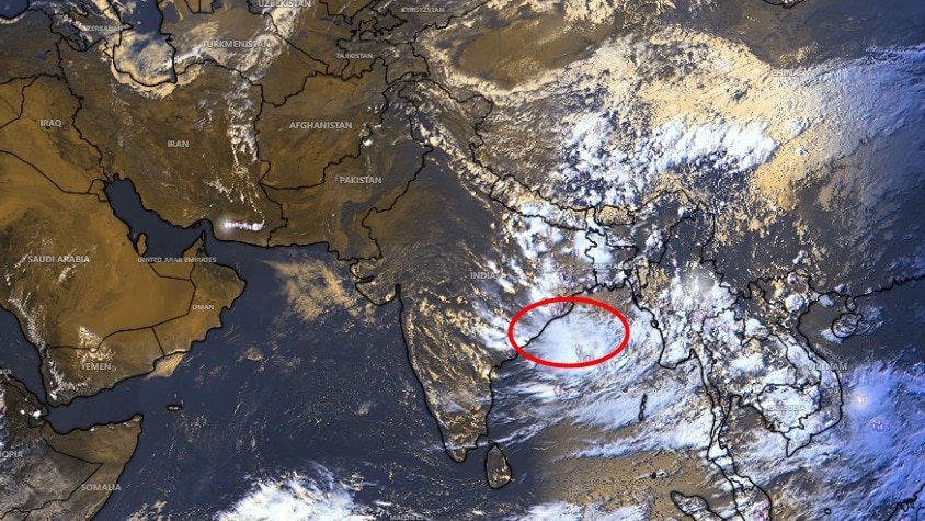
Despite satellite images showing clear skies across 80-90% of India, a new cyclonic circulation in the Bay of Bengal is set to trigger heavy rainfall in several states.
- Upper-air cyclonic circulation active over North Andaman Sea.
- Low-pressure area likely to form over Central and Northwest Bay of Bengal.
- Heavy rain forecasted for Odisha and West Bengal between Sept 9-12.
For the past few days, large swaths of India have experienced a welcome break from the relentless cloud cover and rain. Satellite imagery confirms this lull, showing that nearly 80-90% of the Indian landmass is currently devoid of significant cloud cover, leading many to believe the rainy season has ended.
The Brewing Storm in the Bay of Bengal
However, the serenity is deceptive. According to the India Meteorological Department (IMD), an upper-air cyclonic circulation is persisting over the north Andaman Sea at approximately 5.8 km above mean sea level. This system is the catalyst for a burgeoning low-pressure area in the central and northwest Bay of Bengal.
By September 11, this weather system is expected to influence the coasts of north Andhra Pradesh and south Odisha. The IMD has already issued warnings for heavy rainfall in Odisha on September 9, with 'very heavy' rain predicted for September 10, followed by continued precipitation through September 12.
Why This Matters
BozokMedia analysis shows that these late-season systems are crucial for maintaining soil moisture levels before the onset of the dry winter. However, the unpredictability of such systems can pose risks to coastal infrastructure and late-stage crop harvesting in the eastern belt.
"The transition from monsoon to post-monsoon is rarely linear; the Bay of Bengal often generates 'last-hurrah' systems that can disrupt regional weather patterns."
Understanding Monsoon Withdrawal
There is a common misconception that a few sunny days signal the end of the monsoon. In meteorological terms, monsoon withdrawal is a formal declaration based on strict criteria. It is not merely the absence of rain.
For the IMD to declare withdrawal from Northwest India, several factors must align: a cessation of rainfall for five consecutive days, the establishment of an anticyclonic circulation in the lower atmosphere, and a significant drop in moisture levels. These conditions must also show spatial continuity across the region.
| Metric | Satellite Observation | IMD Meteorological Status |
|---|---|---|
| Sky Condition | Mostly Clear / Cloud-free | Monsoon Still Active |
| Atmospheric Activity | Quiet/Lull | Cyclonic Circulation Brewing |
| Short-term Outlook | Dry Spell | Heavy Rain (Sept 11-15) |
Frequently Asked Questions
1. Has the monsoon officially left India?
No, the IMD has not yet declared the formal withdrawal of the southwest monsoon despite the current clear skies.
2. Which regions will be most affected by the new system?
East, Central, and Western India, particularly Odisha, West Bengal, and Andhra Pradesh, are expected to see renewed rainfall.