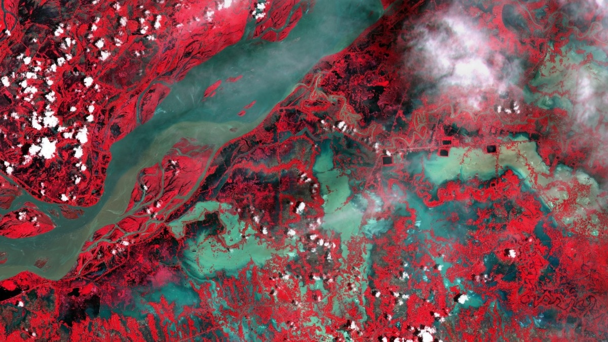
Assam is facing a massive flood emergency as satellite images show the Brahmaputra river corridor expanding to three times its normal width. Over 47 deaths have been confirmed as millions face displacement.
Key Takeaways
- The Brahmaputra river corridor has expanded nearly three times its usual width near Jorhat.
- At least 47 people have died, with 70-80 more reported missing.
- Over 7.21 lakh people across 11 districts and 900 villages are affected.
- Charaideo recorded rainfall 436% above the normal level.
The flood situation in Assam has escalated into one of the state's most severe emergencies in recent years. According to recent satellite imagery from the European Union’s Copernicus Earth-observation programme, the inundated corridor near Jorhat has expanded to nearly 21 km, representing a threefold increase in its visible width compared to pre-flood levels.
The deluge has submerged vast residential areas, tea estates, and fertile croplands. Chief Minister Himanta Biswa Sarma expressed grave concern, stating that the death toll is likely to rise as approximately 70 to 80 people remain missing. The scale of destruction is unprecedented, with 11 districts currently under water.
Why This Matters
BozokMedia analysis shows that this is not merely a seasonal occurrence but an extreme hydrological event driven by intense upstream rainfall. The combination of heavy precipitation in hill catchments and local rainfall has caused tributaries like the Dikhow, Disang, and Janji to breach their banks, flooding areas that rarely see such inundation.
The rapid expansion of the river corridor indicates a catastrophic surge that challenges current flood management protocols.
Data from the Indian Institute for Human Settlements' Global Flood Mapper highlights that Sivasagar is the hardest-hit district, impacting nearly 3.92 lakh people. Furthermore, the agricultural impact is staggering, with over 25,000 hectares of cropland submerged and nearly 1.39 lakh livestock affected.
Impact Comparison: Most Affected Districts
| District | Affected Population (Approx) | Severity Level |
|---|---|---|
| Sivasagar | 3.92 Lakh | Critical |
| Charaideo | 1.10 Lakh | High |
| Jorhat | 97,700 | High |
The India Meteorological Department (IMD) has issued warnings for continued heavy rainfall and thunderstorms through July 30, suggesting that the danger has not yet passed for the saturated regions of Assam and Meghalaya.
Frequently Asked Questions
1. How many people are currently affected by the Assam floods?
Approximately 7.21 lakh people across 11 districts and nearly 900 villages are currently affected.
2. Is there a risk of more rainfall?
Yes, the IMD has forecast heavy rainfall and thunderstorms in Assam and Meghalaya until July 30.