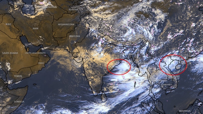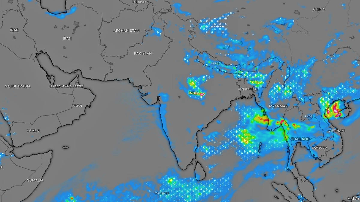
Meteorological models suggest a significant slowdown in monsoon activity across much of India after September 5-10. While Eastern and Northeastern regions may see continued rain, much of the country could face drier conditions.
- A widespread reduction in monsoon activity is expected across most of India after September 5-10.
- Eastern and Northeastern India are likely to experience continued rainfall for the next two weeks.
- The IMD predicts total monsoon rainfall this year may be around 90% of the long-period average.
The pattern of the Indian monsoon is set for a significant shift over the next month. According to recent meteorological models, while the rains have been active, a noticeable break in monsoon activity is expected across large parts of the country between September 5 and September 10. This transition could lead to drier weather conditions for much of the mainland.
Regional Weather Breakdown
The impact of this shift will not be uniform across the subcontinent. While central and western regions prepare for a lull, Eastern and Northeastern India are expected to remain under the influence of monsoon systems for at least the next two weeks. These regions may witness moderate to heavy rainfall, depending on the formation of localized weather systems.
Why This Matters
BozokMedia analysis shows that a mid-September slowdown in rainfall is a critical indicator for the agricultural sector. As farmers transition from the Kharif season to preparations for Rabi crops, the availability of soil moisture and groundwater levels will become paramount for national food security.
Long-range weather models indicate that the second week of September may mark a turning point where monsoon intensity begins to wane across the majority of India.
Looking at the broader context of the 2026 monsoon season, the India Meteorological Department (IMD) had previously projected a slightly below-normal monsoon. Current estimates suggest that total rainfall from June to September might reach approximately 90% of the long-period average (LPA).
Historical Context and Data Comparison
Historically, between 1971 and 2020, the average rainfall during the monsoon months (June-September) stood at approximately 87 cm. The current year's trajectory suggests a deviation below this historical benchmark, highlighting the volatility in seasonal patterns.
| Region | Next 2 Weeks Forecast | Post-Sept 5 Forecast |
|---|---|---|
| Eastern India | Heavy to Moderate Rain | Moderate Rain |
| Northeastern India | Persistent Rainfall | Localized Rain |
| Central/Western India | Moderate Rain | Dry/Low Rainfall |
It is important to note that these are long-range forecasts. Meteorological conditions are dynamic, and the development of new low-pressure systems could trigger unexpected rainfall even during the predicted dry spell.
Frequently Asked Questions
1. Will the monsoon completely stop in September?
No, the monsoon will not cease entirely, but its frequency and intensity are expected to decrease significantly in many regions.
2. Which areas will see the most rain in the coming weeks?
Eastern and Northeastern India are poised to receive the highest amount of rainfall over the next fortnight.