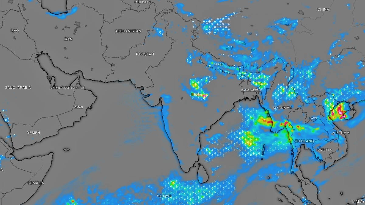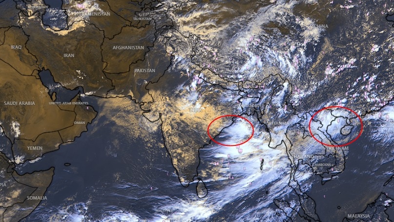
India anticipates an uptick in monsoon activity as two weather systems are forming over the Bay of Bengal and the West Pacific. These systems are expected to enhance rainfall across various parts of the country in the coming days.
- Two weather systems are developing over the Bay of Bengal and the West Pacific.
- An upper-air cyclonic circulation is expected to form over the north Bay of Bengal by the end of this week.
- A low-pressure area could subsequently develop over the northwest Bay of Bengal early next week.
New Delhi: Two significant weather systems are taking shape, poised to bolster monsoon activity across the Indian subcontinent. These developing systems over the Bay of Bengal and the West Pacific are likely to enhance rainfall across various parts of the country in the coming days, signaling a potential extension of the monsoon season. Meteorologists are closely monitoring this evolving pattern.
Upcoming Weather Systems and Their Impact
According to meteorologists, an upper-air cyclonic circulation is expected to form over the north Bay of Bengal towards the end of the week, between August 21 and 27. Following this, a low-pressure area could develop over the northwest Bay of Bengal around the beginning of the following week. It is important to note that a new low-pressure system has not yet formed, but current weather models indicate that conditions are becoming favorable for one in the days ahead.
Low-Pressure Systems Keeping Monsoon Alive
Currently, the primary system influencing the weather is a well-marked low-pressure area situated over northeast Madhya Pradesh and adjoining areas. The monsoon trough is passing through this system and extending towards the northeast Bay of Bengal, helping to sustain rainfall activity across parts of central, eastern, and northern India. Such low-pressure systems are a familiar feature of the southwest monsoon and have been frequent this season. These systems draw moisture inland and can produce widespread rainfall as they move across the landmass.
Recent Rainfall and Current Status
Recent systems have already delivered heavy rainfall across parts of eastern and central India. The current spell has included heavy to very heavy rainfall in parts of Odisha, Chhattisgarh, Madhya Pradesh, and neighboring regions, which has helped prevent a prolonged break in monsoon activity.
What's Ahead?
The India Meteorological Department's (IMD) forecast points to continued rainfall over large parts of eastern and central India. Sub-Himalayan West Bengal and Sikkim, Odisha, Chhattisgarh, and East Madhya Pradesh are expected to experience fairly widespread to widespread rain, with isolated heavy spells. Parts of East Madhya Pradesh are also facing the possibility of very heavy rainfall during the current spell.
Activity in Northeast India
The Northeast is also likely to remain active, with Arunachal Pradesh, Assam, and Meghalaya among the areas that can receive isolated heavy rainfall. The developing system in the Bay of Bengal could provide another boost to rainfall later, but its eventual strength, location, and movement will become clearer only as it develops.
Why This Matters
BozokMedia analysis shows that these twin weather systems not only sustain the current monsoon activity but could potentially extend it. This is crucial for regions still experiencing below-normal rainfall or requiring continuous moisture for agricultural activities. The development and track of these systems will be vital for Indian agriculture and water resource management.
“The simultaneous formation of two weather systems in the Bay of Bengal could signal a significant shift in monsoon dynamics, potentially enhancing rainfall amounts and duration across large swathes of the country.”
Frequently Asked Questions
- Will these new weather systems bring rain to all parts of the country?
- What could be the impact of these weather systems on the long-term monsoon trend?