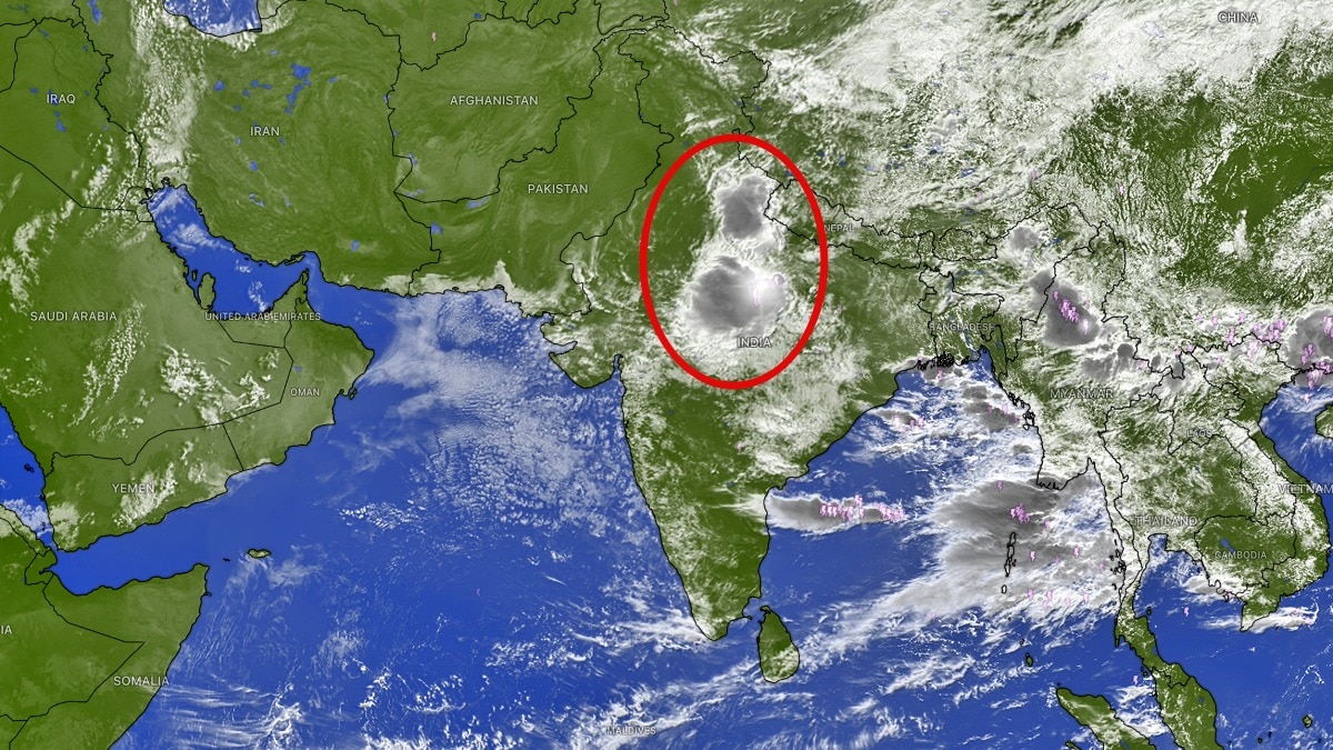
Satellite imagery shows a significant accumulation of clouds over Uttar Pradesh, signaling an active monsoon spell for central and eastern India. However, a dry air intrusion is limiting rainfall in the northwest.
- Massive cloud formations detected over Uttar Pradesh and central India.
- Heavy to moderate rainfall predicted for UP, MP, Bihar, and West Bengal.
- Dry air intrusion is suppressing thunderstorm activity in Rajasthan and Gujarat.
Latest satellite imagery has revealed an extensive buildup of clouds across central and eastern India, indicating that the southwest monsoon is set to remain highly active. The most striking feature is the massive cloud formation observed over Uttar Pradesh, which is expected to trigger significant rainfall episodes in the coming days.
According to the 48-hour rainfall outlook provided by the AIFS weather model, several states including Madhya Pradesh, Bihar, Jharkhand, Odisha, Uttarakhand, and the Northeastern states are braced for moderate to heavy showers. This active belt is being fueled by high moisture availability and atmospheric stability conducive to widespread thunderstorm development.
Why This Matters
BozokMedia analysis shows that India is currently witnessing a stark meteorological divide. While the eastern and central corridors are entering a period of replenishment, the western and northwestern regions are facing a suppression of monsoon activity due to atmospheric shifts.
The intrusion of dry air into the middle levels of the atmosphere is effectively acting as a cap, preventing deep convection and cloud growth in the northwest.
In contrast to the heavy rain expected in the east, the northwest is experiencing a completely different weather pattern. A massive intrusion of dry air is sweeping across Rajasthan, Gujarat, Punjab, Haryana, and Jammu and Kashmir, extending even toward the Arabian Sea. This phenomenon is crucial because it affects the middle levels of the atmosphere, inhibiting the moisture required for deep cloud formation.
Even when surface temperatures suggest convective potential, this high-level dry air weakens developing thunderstorms. Consequently, large parts of western India are expected to remain mostly dry, with only isolated or passing showers possible in coastal regions like Maharashtra and Goa.
Frequently Asked Questions
1. Which states will receive the most rainfall this week?
Uttar Pradesh, Madhya Pradesh, Bihar, Jharkhand, West Bengal, and the Northeastern states are expected to see the most significant rainfall.
2. Why is the monsoon weak in Northwest India?
A large mass of dry air is moving through the region, suppressing cloud formation and limiting thunderstorm activity.