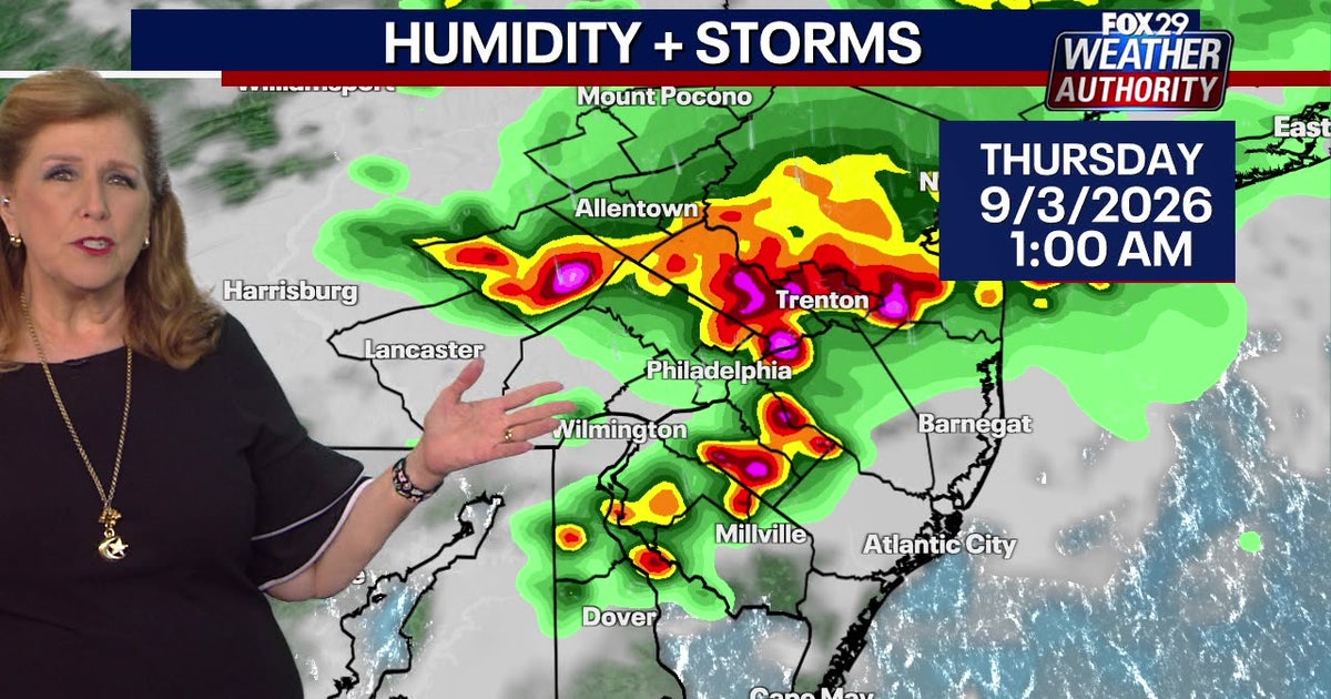
Following Tuesday's damaging weather, forecasters warn of more intense storms hitting the Philadelphia area on Wednesday and Thursday. Residents should prepare for high winds and heavy downpours.
- Severe storms with damaging winds and heavy rain are expected Wednesday afternoon and evening.
- The I-95 corridor, including Philadelphia and Trenton, is at high risk.
- Unsettled weather will persist through Friday before a pleasant Labor Day weekend.
As residents across the Philadelphia metropolitan area begin the arduous task of cleaning up from Tuesday's ferocious storms—which uprooted trees and caused widespread power outages—the National Weather Service has issued a stern warning: the worst may not be over yet.
Severe Weather Outlook for Wednesday
Forecasters indicate that the entire Philadelphia region is at risk for severe weather on Wednesday. The primary threats include damaging wind gusts and intense downpours. These scattered storms are projected to move into the city during the late afternoon and early evening hours.
The impact is not limited to Pennsylvania; parts of southern and central New Jersey should also brace for similar conditions. Meteorologists note that while temperatures may dip slightly, the lingering humidity will provide the necessary fuel for storm development.
Why This Matters
BozokMedia analysis shows that consecutive storm systems place immense strain on local infrastructure. The combination of saturated ground from Tuesday's rain and Wednesday's high winds significantly increases the risk of tree falls and structural damage, particularly along high-traffic zones like the I-95 corridor.
The exact timing of these storms remains conditional on how surface air stability evolves, making real-time monitoring crucial.
Extended Forecast: Thursday and Friday
The instability is expected to continue into Thursday. Latest meteorological models suggest that the I-95 corridor, specifically targeting Philadelphia and Trenton, will bear the brunt of the system. Temperatures are expected to climb back into the 90s, exacerbating the muggy conditions and fostering more isolated storm cells.
This pattern of scattered rain and humidity is expected to last through Friday. However, there is a silver lining for those planning holiday activities: a near-perfect and sunny Labor Day Weekend is on the horizon.
Historical Context: Tuesday's Impact
Tuesday's storms were particularly violent, triggering tornado warnings in Burlington County. While no tornado touchdown was confirmed, the wind speeds were sufficient to knock out power for thousands and cause fires due to lightning strikes, notably in Dover, Delaware.
Frequently Asked Questions
1. When is the peak time for storms on Wednesday?
Answer: Most models suggest the peak activity will occur during the late afternoon and early evening.
2. Will the weather clear up for Labor Day?
Answer: Yes, after the unsettled weather concludes on Friday, a pleasant weekend is expected.
