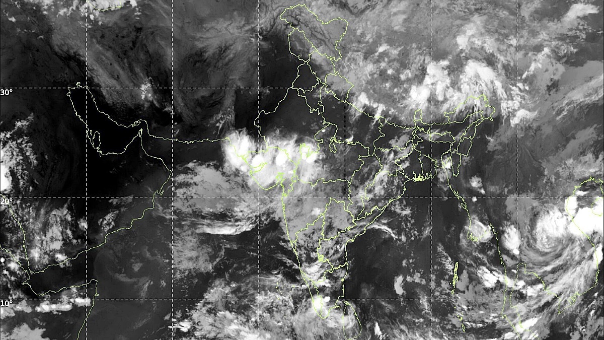
A massive weather shift is hitting Gujarat with four active systems, triggering a Red Alert in Navsari and Valsad. Heavy rainfall is expected across the state until September 15.
- Four weather systems simultaneously active in Gujarat.
- Red Alert issued for Navsari, Valsad, Daman, and Dadra Nagar Haveli.
- Heavy to extremely heavy rainfall predicted from Sep 12 to Sep 15.
- Saurashtra and Kutch facing a 40% rainfall deficit.
The monsoon is set to intensify significantly across Gujarat as the India Meteorological Department (IMD) has confirmed the activation of four distinct weather systems. This complex atmospheric setup is expected to trigger heavy to extremely heavy rainfall across various regions of the state from September 12 to September 15, 2026. While the rain brings hope to farmers, it also poses a significant flood risk to coastal and southern regions.
District-wise Alert Breakdown
According to official meteorological data, an Orange Alert has been issued for Navsari, Valsad, and Dang districts for September 12. However, the situation is expected to escalate on September 13, when a Red Alert will be in effect for Navsari, Valsad, Daman, and Dadra Nagar Haveli due to the anticipation of extremely heavy downpours. Furthermore, 7 other districts, including Surat and Vadodara, remain under a Yellow Alert for scattered heavy rainfall.
Current observations show that parts of Mahisagar and Gir Somnath have already experienced light showers and cloudy skies. In Gir Somnath, several villages reported rainfall, providing temporary relief from the heat.
Why This Matters
BozokMedia analysis shows that the current weather pattern presents a dual challenge for the state. While the southern belt faces immediate flood risks, the broader state-wide statistics reveal a worrying trend: a 21% overall deficit in monsoon rainfall this season. Most critically, the Saurashtra and Kutch regions are grappling with a 40% rainfall shortage, making the upcoming heavy spells vital for agriculture and groundwater recharge.
The simultaneous activation of four weather systems creates a high-impact scenario for flash floods and localized inundation.
Meteorological Drivers
Experts point to a robust low-pressure area formed near the coasts of Odisha and North Andhra Pradesh, combined with a cyclonic circulation in the West-Central Bay of Bengal. This system is expected to move in a west-northwest direction over the next 24 hours. Additionally, a trough line extending from North Rajasthan to the low-pressure zone is expected to trigger thunderstorms and winds speeds of 30-40 km/h.
| Region | Alert Level | Expected Condition |
|---|---|---|
| Navsari/Valsad/Daman | Red Alert | Extremely Heavy Rain |
| Dang | Orange Alert | Heavy Rain |
| Surat/Vadodara | Yellow Alert | Scattered Heavy Rain |
| Saurashtra/Kutch | Deficit Zone | 40% below average |
Frequently Asked Questions
1. How long will the heavy rain last in Gujarat?
The heavy rainfall period is expected to remain active from September 12 through September 15.
2. Which districts are at the highest risk?
Navsari, Valsad, Daman, and Dadra Nagar Haveli are under Red Alert and face the highest risk.