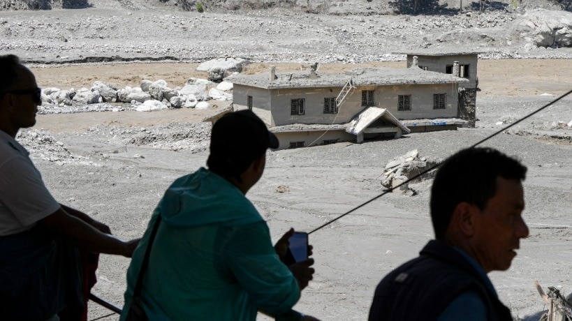
A massive barrier lake formed by glacial collapse and landslides on the Nepal-China border is threatening catastrophic downstream flooding. With 469 dead already, the rising water levels pose a renewed risk to thousands.
- A glacial collapse has created two new lakes on the Nepal-China border.
- A massive 'barrier lake' formed by landslide debris poses an imminent outburst flood risk.
- Casualties have reached 469, with over 1,000 people still missing.
- The lake holds approximately 1.5 to 2 million cubic meters of water.
Following the catastrophic glacial collapse that devastated parts of Nepal and Tibet, a new and even more pressing threat has emerged. A massive barrier lake, formed by the accumulation of debris and landslides, is rapidly rising near the border, creating the potential for a sudden, destructive outburst flood.
Authorities in Nepal's Rasuwa district have reported that the river levels are rising steadily. This new geological feature is not a single entity; scientists have identified two distinct lakes. One is located at a higher altitude near the glacier, while the larger, more dangerous one sits in a valley where a massive landslide has effectively dammed the river system.
Why This Matters
BozokMedia analysis shows that the instability of these natural dams is a critical concern for regional security and humanitarian efforts. The debris holding back millions of cubic meters of water is loosely packed, meaning even a minor overflow could trigger a massive, debris-laden surge that would devastate downstream communities and critical infrastructure like hydropower tunnels.
"The danger is not just the lake itself, but the possibility of sudden dam failure. In a steep valley like this, even a short-lived breach can generate a fast-moving debris-laden flood with very little warning." - Pawan Bhattarai, Tribhuvan University.
The scale of the potential disaster is immense. China's Ministry of Water Resources estimates the lake contains between 1.5 to 2 million cubic meters of water—the equivalent of roughly 1,200 Olympic-sized swimming pools. Furthermore, an additional 3 million cubic meters of water could flow into the lake within the next three days, significantly increasing the pressure on the natural barrier.
The geographical challenges are complicating rescue and mitigation efforts. The lake is located near the confluence of the Chhochen Khola and Purepu Tsangpo rivers. The terrain is characterized by steep cliffs and isolated ridges, making it nearly impossible to deploy heavy machinery or large engineering crews to manage the water levels safely.
While Chinese engineering teams are utilizing 3D modeling and aerial surveys to monitor the situation, the remote nature of the site remains a major hurdle. The primary concern for the National Disaster Risk Reduction and Management Authority (NDRRMA) is that the natural dam could fail without warning, making timely evacuation essential for those living along the Bhotekoshi and Trishuli rivers.
Historical Background
Glacial Lake Outburst Floods (GLOFs) have become increasingly frequent in the Himalayan region due to global warming. As glaciers retreat, they leave behind unstable moraines and create proglacial lakes. When these natural barriers fail, the resulting floods can travel hundreds of kilometers downstream, causing unprecedented destruction.
Frequently Asked Questions
Question 1: How did the lake form so suddenly?
Answer: The glacial collapse triggered massive landslides that pushed huge volumes of rock, ice, and mud into the river valley, creating a natural blockage.
Question 2: Is there any way to drain the lake?
Answer: While controlled breaching is a theoretical option, the complex and steep terrain makes it extremely difficult and potentially dangerous to implement.