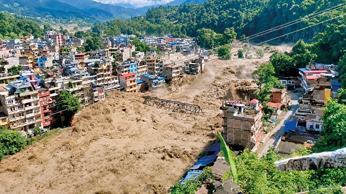
The escalating complexity of natural hazards in the Himalayan region is outpacing current warning technologies. Experts warn that integrated, high-tech systems are crucial to mitigate growing risks.
- Himalayan hazards are evolving into multi-hazard events, such as simultaneous landslides and flash floods.
- Current early warning systems (EWS) are insufficient to handle the new complexities of climate-driven shifts.
- Immediate investment in satellite monitoring and community-level integration is required.
The Himalayan mountain range, a vital ecological lifeline for billions, is facing a new era of geological and climatic instability. Recent observations indicate that natural hazards in this region are no longer isolated incidents. Instead, they are becoming increasingly complex, where one event—such as heavy rainfall—triggers a cascade of secondary disasters including landslides, glacial lake outburst floods (GLOFs), and debris flows.
This shift is largely attributed to the rapid pace of climate change, which has altered precipitation patterns and accelerated glacial melting. Traditional warning systems, often designed to monitor single parameters like river levels or rainfall intensity, are struggling to account for these interconnected phenomena. As the terrain becomes more volatile, the window for effective evacuation shrinks, making outdated technology a liability.
Why This Matters
BozokMedia analysis shows that the failure to modernize Himalayan warning systems poses a systemic risk to regional stability, affecting water security, hydropower infrastructure, and the lives of millions living in the mountain ecosystems.
We are moving from a world of predictable seasonal hazards to a world of unpredictable, multi-hazard emergencies in the Himalayas.
Historical Background: History has shown that the Himalayas are prone to seismic and climatic volatility. However, the frequency and intensity of disasters like the 2013 Uttarakhand floods and recent catastrophic events in Sikkim demonstrate that the scale of modern hazards has surpassed historical norms, necessitating a paradigm shift in disaster preparedness.
To bridge this gap, experts advocate for an integrated approach that combines high-resolution satellite imagery, ground-based IoT sensors, and sophisticated AI modeling. Furthermore, the 'last mile' of communication—ensuring that warnings actually reach remote mountain villages in time—remains a critical vulnerability that must be addressed through localized technology and community training.
Frequently Asked Questions
Question 1: Why are Himalayan disasters becoming more complex?
Answer: Climate change is causing multiple environmental stressors to act simultaneously, leading to compound events like landslides triggered by melting glaciers and heavy rain.
Question 2: What is the main limitation of current warning systems?
Answer: Most current systems are designed for single-hazard scenarios and lack the integrated data needed to predict multi-hazard cascades.