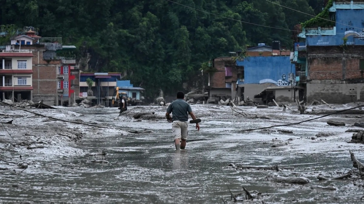
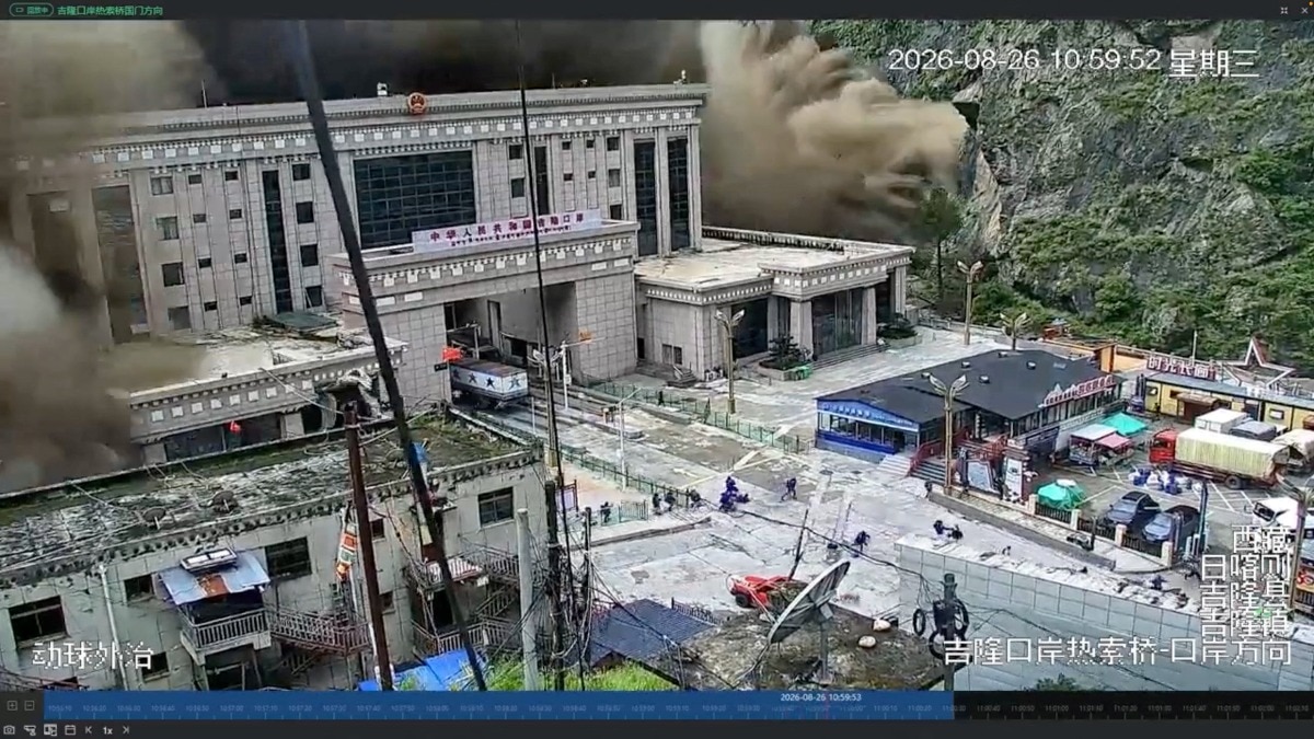
A massive flash flood in the Himalayan region has completely obliterated a strategic Nepal-Tibet border checkpoint. Chinese rescue teams, after a grueling 50-hour journey, found only debris and destruction at the core disaster zone.
- A critical Nepal-Tibet border checkpoint was destroyed by sudden flash flooding.
- Chinese rescue teams reached the disaster epicenter after a 50-hour struggle.
- The site is reported to contain nothing but massive debris and structural ruins.
The fragile ecosystem of the Himalayas has once again demonstrated its volatile nature as a devastating flash flood has wiped out a vital checkpoint on the Nepal-Tibet border. Rescue teams dispatched from China arrived at the scene to find a landscape of total destruction, describing the site as having 'nothing but ruins' left behind by the surging waters and debris.
The operation was fraught with extreme difficulty, with rescue teams battling treacherous terrain and blocked pathways for nearly 50 hours before reaching the heart of the disaster zone. The intensity of the flood in the Gyirong region was so immense that it effectively erased the existing infrastructure, leaving only a trail of mud, rocks, and shattered structures in its wake.
Why This Matters
BozokMedia analysis shows that the increasing frequency of extreme weather events in the Himalayan corridor poses a direct threat to regional stability and international logistics. The destruction of such border crossings disrupts essential trade routes and complicates cross-border communication and security protocols between Nepal and the Xizang region.
The scale of destruction witnessed at the Gyirong checkpoint underscores the growing vulnerability of high-altitude infrastructure to climate-induced disasters.
In response to the catastrophe, top leadership in China has convened a high-level meeting to oversee the rescue and recovery efforts in the Xizang (Tibet) region. The discussions are focused on mobilizing resources to restore connectivity and providing immediate relief to the affected mountainous communities.
Visual data and animations tracing the path of the debris flow indicate that the force of the water was sufficient to carry massive boulders and heavy sediment, which acted as a battering ram against the checkpoint facilities. The environmental impact on the local topography is expected to be long-lasting.
Frequently Asked Questions
1. How long did it take for rescue teams to reach the site?
It took approximately 50 hours of navigating through debris and difficult terrain for the teams to reach the core disaster zone.
2. What is the current status of the border crossing?
The checkpoint has been completely destroyed and is currently non-functional due to the massive accumulation of debris and structural damage.