New satellite data reveals that a massive bedrock collapse beneath a glacier triggered the catastrophic flooding in Nepal. The disaster has devastated settlements along the Trishuli River.
- A large section of bedrock beneath a glacier on Langtang Lirung peak collapsed.
- The resulting avalanche of ice, rock, and debris created a powerful mudflow.
- The Trishuli River has significantly widened and changed color due to heavy sediment.
Earth scientists reviewing recent satellite imagery have uncovered the harrowing sequence of events behind the catastrophic flooding along the Nepal-China border. The data suggests that the disaster was triggered by a massive collapse of bedrock beneath a glacier, which sent an unstoppable avalanche of ice, rock, and debris cascading into the valleys below.
According to scientists Kristen Cook and Dan Shugar, the imagery indicates that a significant portion of the glacier on the Langtang Lirung peak, near the Tibetan border, broke away. Crucially, the failure was not limited to the ice itself but involved the underlying mountain structure, which propelled massive boulders and debris downstream at high velocity.
Why This Matters
BozokMedia analysis shows that these high-altitude geological failures represent a growing threat to mountain communities. As the structural integrity of the Himalayas is tested by environmental stressors, the scale of potential downstream destruction increases exponentially.
This event is the largest glacier-related flood I have witnessed, leaving behind a wasteland that could take years to recover.
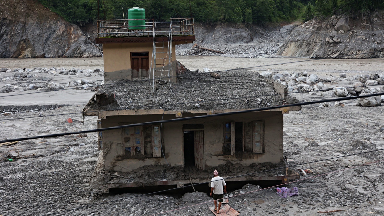
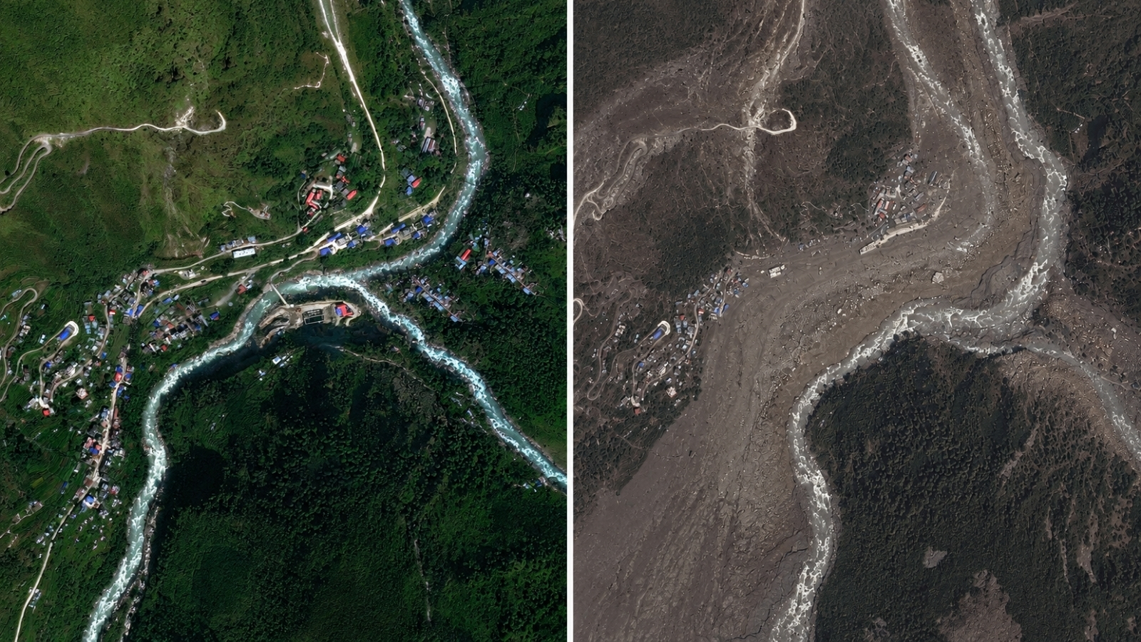
The impact on human settlements has been devastating. Satellite frames from Kolpurtar, Betrawati, and Syapru Besi show a landscape transformed by mud. The Trishuli River, once characterized by greenish waters, has turned a dark, murky brown and black as it carries immense volumes of sediment. In Syapru Besi, a key hub for Langtang trekkers, buildings and roads have been completely swept away.
Mountain geographer Alton Byers from the University of Colorado Boulder described the aftermath as a complete wasteland. While scientists are investigating the role of climate change, Cook and Shugar noted that while rising temperatures weaken permafrost and glaciers, a direct definitive link to this specific collapse is still being studied. However, the destabilization of high-altitude slopes due to warming is a significant concern.
| Location | Pre-Flood Condition | Post-Flood Condition |
|---|---|---|
| Trishuli River | Clear, Greenish Water | Wide, Black/Brown Muddy Flow |
| Syapru Besi | Active Tourist Destination | Submerged Structures & Debris |
| Timure | Developed Village/Roads | Devastated/Washed Away |
Frequently Asked Questions
Question 1: What caused the sudden intensity of the Nepal floods?
Answer: A massive mountain bedrock failure sent a mixture of ice, boulders, and mud downstream, creating a high-energy flood.
Question 2: Are the villages safe now?
Answer: Authorities are still monitoring new lakes and risks created by the collapse, as the landscape remains highly unstable.