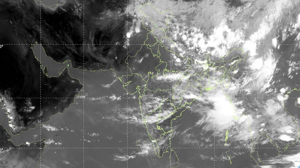
Satellite imagery reveals that rain‑bearing monsoon clouds are absent over a large portion of India. Experts attribute the sudden dip to a powerful cyclone forming in the western Pacific, which is temporarily diverting moisture away from the subcontinent.
Key Takeaways
- Satellite images show 70‑80% of India lacking rain‑bearing monsoon clouds
- A powerful cyclone in the western Pacific is diverting moisture away from the Indian monsoon
- The Indian Meteorological Department warns of reduced rainfall in central and southern regions in the coming days
New Delhi, July 11, 2026 – The latest satellite photographs released by the Indian Meteorological Department (IMD) display a striking absence of monsoon rain clouds across roughly 70‑80% of the country. While the nation experienced continuous downpours and localized flooding just days ago, the sudden clearing of clouds has left both the public and scientists puzzled.
Pacific Cyclone Pulling the Moisture
Atmospheric researchers explain that the primary driver behind this anomaly is a vigorous cyclone currently brewing in the western Pacific Ocean, thousands of kilometres away from the Indian subcontinent. The system is siphoning off the moist air that typically fuels the south‑west monsoon, causing a temporary weakening of the monsoon circulation over India.
Current Monsoon Status and Forecasts
The monsoon made its country‑wide arrival on July 9, but its onset was notably weak. By the end of June, rainfall across the nation was about 40% below the long‑term average – one of the lowest early‑season totals recorded in recent decades. Early July brought sporadic showers in some states, yet central and southern regions continue to receive far less rain than usual. IMD projects that for the next 7‑10 days, several parts of central and southern India will experience continued deficits, and the overall monthly rainfall total is expected to fall short of the climatological norm.
Historical Context and Agricultural Implications
Such monsoon irregularities have been documented since the 1970s, often linked to strong El Niño events that similarly disrupt moisture flow. For agriculture, the reduced precipitation raises concerns over water stress in paddy fields, potentially curbing crop yields. Experts advise farmers to adopt water‑saving techniques and consider alternative, less water‑intensive crops to mitigate the risk.
What Lies Ahead?
Scientists caution that if the Pacific cyclone weakens, the monsoon is likely to regain its vigor, bringing widespread rainfall back to the affected regions. Nonetheless, continuous monitoring of the El Niño Southern Oscillation, sea‑surface temperatures, and broader climate change trends remains essential. In short, the monsoon has not disappeared; it is merely navigating a brief weak phase before re‑establishing its familiar rhythm.