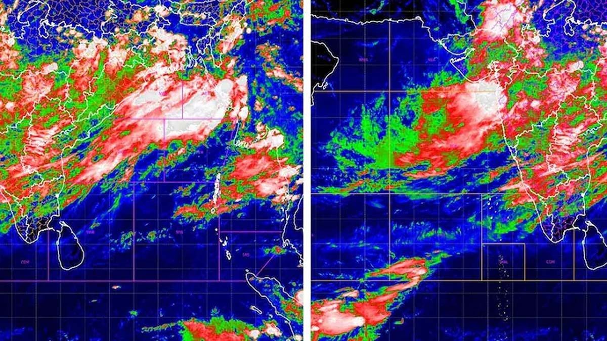
Latest INSAT-3DR and INSAT-3DS satellite imagery shows a massive monsoon system spanning from the Bay of Bengal to the Arabian Sea, with five active cyclonic circulations.
Key Takeaways
- ISRO's INSAT-3DR and INSAT-3DS satellites have identified five active cyclonic circulations.
- A strong monsoon trough is connecting the Bay of Bengal and the Arabian Sea.
- Heavy rainfall predicted for Delhi, UP, Bihar, Odisha, and Madhya Pradesh.
- Cloud top temperatures as low as -70°C indicate high-intensity rainfall potential.
The Indian Space Research Organisation (ISRO) has provided a visual breakthrough in understanding India's current weather patterns. High-resolution imagery from the INSAT-3DR and INSAT-3DS satellites has mapped out a massive monsoon 'route' stretching across the Indian subcontinent. The data reveals a complex network of five cyclonic circulations and a robust monsoon trough, signaling an intense period of rainfall across various states.
According to meteorologists, these systems are positioned over Haryana, North-Eastern Madhya Pradesh, South-Western Rajasthan, North Chhattisgarh, and the West-Central Bay of Bengal. This alignment allows for a continuous influx of moisture from both the Bay of Bengal and the Arabian Sea. Satellite observations show dense cloud cover over Odisha, West Bengal, Jharkhand, and Bihar, with cloud-top temperatures plummeting to between -50°C and -70°C, suggesting deep, convective clouds capable of producing torrential rain.
Why This Matters (इसके मायने क्या हैं)
BozokMedia analysis shows that this multi-system alignment is a critical turning point for the Indian monsoon season. While the recent dry spell provided some relief from humidity, the sudden activation of five systems could lead to rapid changes in local climates, affecting everything from daily commutes to large-scale agricultural planning.
From an economic standpoint, the synchronization of these systems is vital. If the rainfall is well-distributed, it will bolster India's agricultural output and recharge groundwater levels. However, if these systems intensify into extreme weather events, the resulting urban flooding and potential crop damage could pose significant challenges to the national economy and disaster management resources.
"The simultaneous activation of multiple cyclonic systems creates a synergistic effect that can override the drying influence of El Niño."
Historical Background
The Indian monsoon is a seasonal reversal of winds that has historically dictated the country's agrarian rhythm. The interaction between the Bay of Bengal and the Arabian Sea is a key driver of rainfall distribution. Historically, periods of high cyclonic activity during the monsoon have been linked to both bountiful harvests and devastating floods. The phenomenon of El Niño—a warming of surface waters in the eastern Pacific—traditionally suppresses monsoon rains, but as seen currently, local atmospheric conditions can create powerful counter-currents.
| Feature | Previous Weather State | Current Monsoon State |
|---|---|---|
| Cyclonic Activity | Low/Sparse | 5 Active Circulations |
| Moisture Inflow | Unidirectional | Bi-directional (Both Seas) |
| Rainfall Intensity | Moderate/Low | Heavy to Very Heavy |
Frequently Asked Questions (अक्सर पूछे जाने वाले प्रश्न)
Question 1: Is El Niño still affecting the weather?
Answer: Yes, El Niño is still present, but the current strong monsoon trough and cyclonic systems are mitigating its impact.
Question 2: Which regions should prepare for heavy rain?
Answer: Central India, the Western Coast, Western Himalayan states, and Northeast India are expected to see significant rainfall.