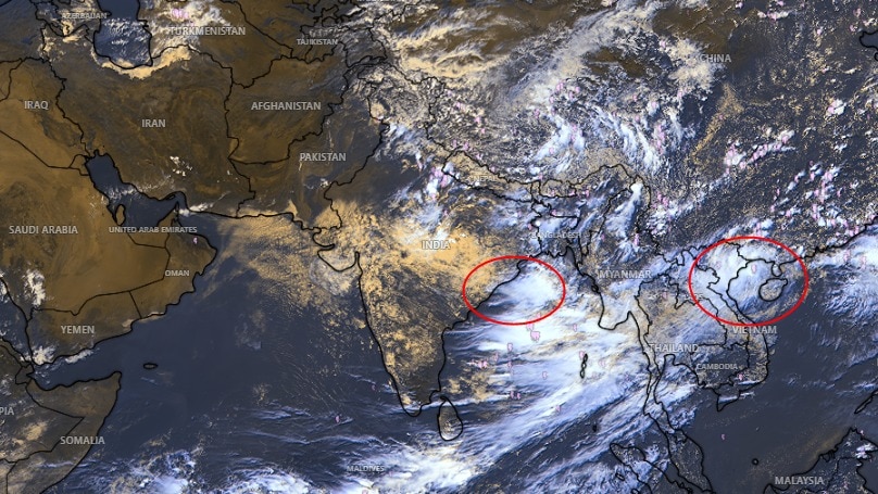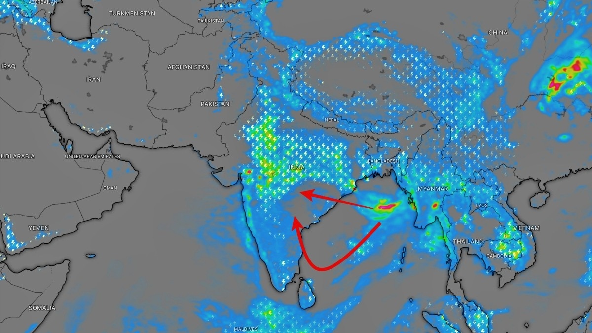
A developing low-pressure area in the northwest Bay of Bengal is set to trigger widespread heavy rainfall across Odisha and central India. The monsoon shows no signs of retreating.
Key Takeaways
- A low-pressure area is expected to form over the northwest Bay of Bengal around August 12.
- Odisha, Chhattisgarh, Jharkhand, and Madhya Pradesh are on high alert for heavy rain.
- The active monsoon trough is driving moisture toward the eastern coast.
The Indian monsoon is maintaining its momentum as the Bay of Bengal prepares to churn out a new weather system. According to meteorological forecasts, a Low Pressure Area is likely to develop over the northwest Bay of Bengal and adjoining areas, potentially bringing heavy to very heavy rainfall to eastern and central India in the coming days.
This developing system is expected to strengthen the existing monsoon circulation. As the system moves inland, it will draw significant moisture toward the eastern coast, increasing rainfall intensity. The primary impact is anticipated in Odisha, where isolated heavy downpours are forecast for August 12 and 13, raising concerns about localized flooding and waterlogging.
Why This Matters
BozokMedia analysis shows that the current positioning of the monsoon trough—south of its normal location—is a critical factor. This southward shift helps concentrate moisture and rising air over central and eastern India, creating the perfect environment for sustained and widespread precipitation. The Bay of Bengal acts as a primary engine, transporting massive amounts of moisture to the Indian landmass.
The formation of low-pressure systems in the Bay of Bengal is the fundamental driver of India's seasonal rainfall patterns.
Beyond Odisha, the system is poised to affect Chhattisgarh, Jharkhand, Madhya Pradesh, and parts of the Gangetic plains. Satellite imagery already indicates increasing cloud build-up, suggesting that the system is gaining strength as it approaches the coast.
Historical Background
Historically, the Bay of Bengal has been the most significant contributor to the Indian Summer Monsoon. The thermal properties of these warm waters facilitate the creation of low-pressure zones, which act as atmospheric pumps, pulling moisture-laden winds from the ocean into the heart of the subcontinent, sustaining the agricultural cycle.
Frequently Asked Questions
1. Which states will be most affected by this new system?
Odisha is expected to see the most immediate impact, followed by Chhattisgarh, Jharkhand, and Madhya Pradesh.
2. Will this lead to flooding?
Heavy to very heavy rainfall in vulnerable areas of Odisha could lead to localized flooding and swollen rivers.