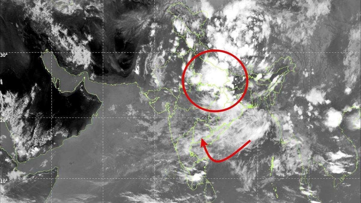
The Bay of Bengal is set to become hyperactive, spawning multiple low-pressure systems throughout August. This development is expected to boost rainfall across central and northern India.
Key Takeaways
- Multiple low-pressure systems are expected to form in the Bay of Bengal through late August.
- Widespread rainfall is forecasted for Central, Eastern, and Northern India.
- The activity is expected to prevent a prolonged monsoon break.
- Crucial moisture inflow will benefit states like Odisha, West Bengal, and Uttar Pradesh.
India's monsoon is gearing up for a highly active phase. Recent weather models indicate that the Bay of Bengal is entering a hyperactive state, capable of continuously generating low-pressure systems for the remainder of August.
According to rainfall projections from the European Centre for Medium-Range Weather Forecasts (ECMWF), the next 15 days are poised to bring sustained and widespread precipitation across large swathes of central, eastern, and northern India. Meteorologists highlight that this trend is crucial as it prevents a major 'break phase' in the core monsoon regions.
Why This Matters
BozokMedia analysis shows that the Bay of Bengal acts as the primary 'rain factory' for the subcontinent. The continuous formation of these systems ensures a steady supply of moisture. This is particularly vital as it may offset the suppressive effects typically associated with El Nino-like conditions, maintaining a robust monsoon circulation.
The succession of low-pressure systems will act as a critical driver to replenish reservoirs and support the kharif cropping season.
Forecast charts suggest that these fresh systems will move inland, carrying massive amounts of moisture into Odisha, West Bengal, Jharkhand, Bihar, Chhattisgarh, Madhya Pradesh, and Uttar Pradesh. This sequence of rain is expected to improve soil moisture levels significantly.
Historical Background
Historically, the intensity of the Indian monsoon has been heavily dictated by the thermal dynamics of the Bay of Bengal. While monsoon breaks often lead to rainfall deficits and agricultural distress, a series of low-pressure systems has traditionally been the mechanism used by nature to redistribute moisture and balance seasonal deficits.
Frequently Asked Questions
1. Which regions will see the most impact?
The strongest impact is expected over East, Central, and North India.
2. Will this help the farming sector?
Yes, the sustained rainfall is expected to provide a much-needed boost to the ongoing kharif crops.