The immediate threat of a glacial lake burst near the China-Nepal border has decreased as water levels steadily decline. Authorities are monitoring the situation 24/7 using drones and radar.
- The surface area of the glacial lake has reduced to approximately 99,000 square meters.
- Water is draining naturally, significantly lowering the risk of a sudden burst.
- A second, larger lake (over 120,000 sq. meters) has been identified and is under surveillance.
- Advanced technology, including drones and radar, is being used for real-time monitoring.
In a significant development following the devastating glacier burst near the China-Nepal border, authorities have reported that the immediate risk of a catastrophic lake burst has diminished. As the water from the newly formed glacial lake begins to drain naturally, the overall volume and surface area of the lake are decreasing, providing much-needed relief to the disaster-stricken regions.
Scientific Observations and Data
According to the Ministry of Water Resources of China, satellite imagery captured between Thursday and Saturday showed a consistent decline in the lake's water levels. By Saturday afternoon, portions of the lake bed had begun to emerge. The surface area of the lake has shrunk to roughly 99,000 square meters—comparable to about 14 football fields—marking a reduction of 21,000 square meters since Thursday.
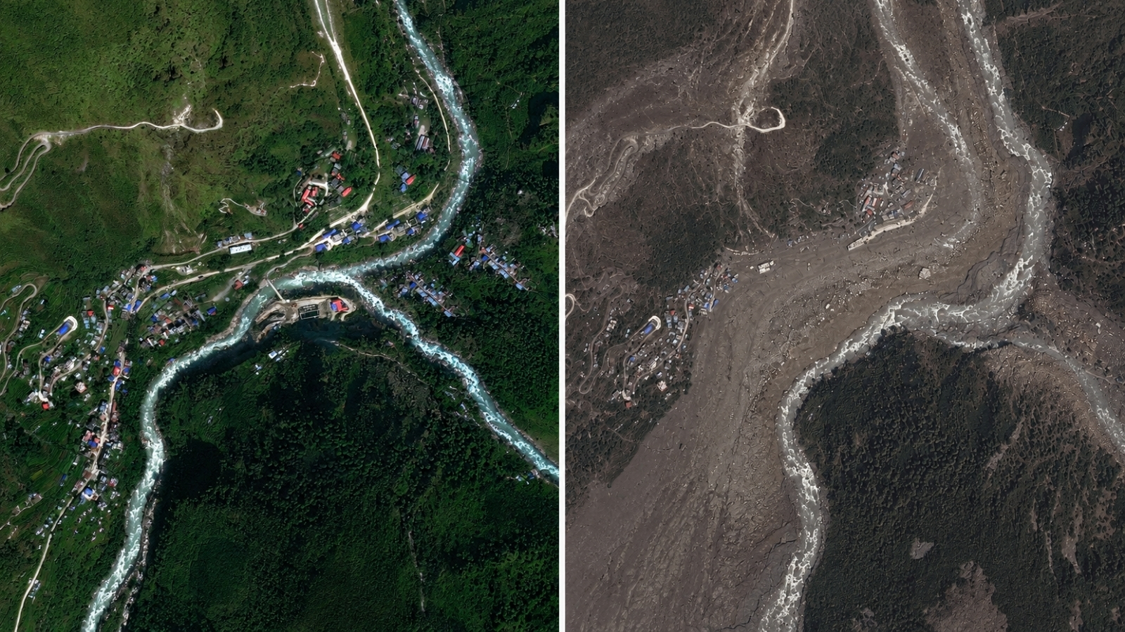
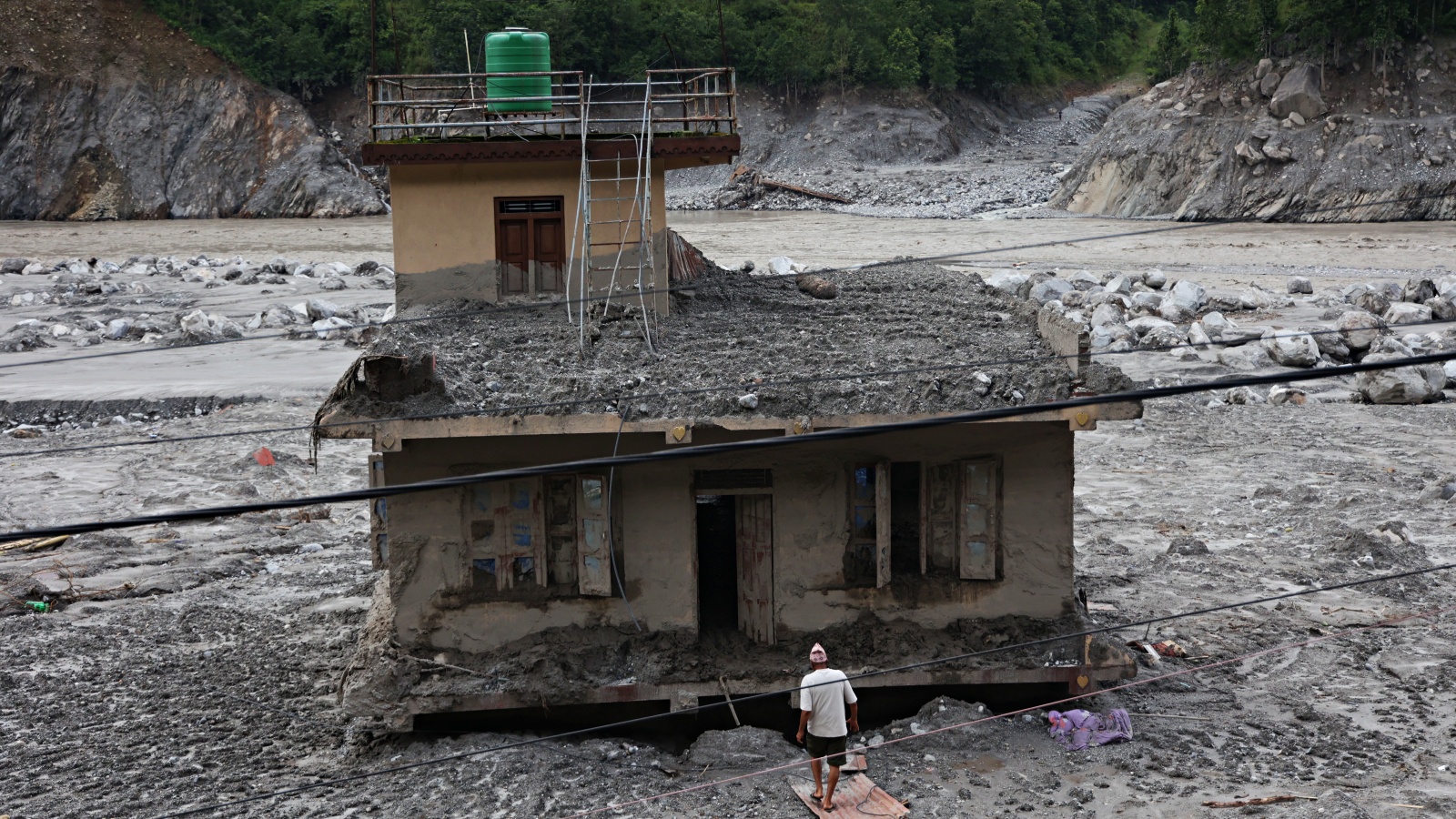
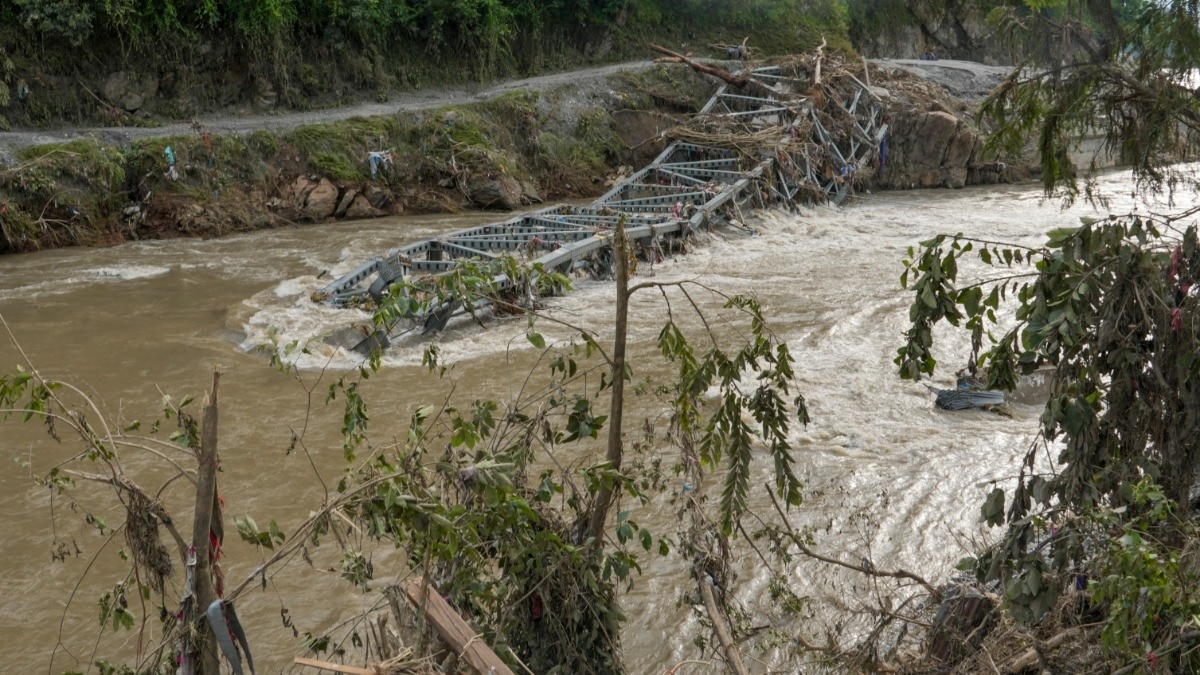
The lake is situated near the confluence of two rivers on the border of the Tibet region and Nepal. The disaster, triggered by a massive glacier collapse on Wednesday, sent a torrent of rocks, ice, and debris down the Himalayan river systems, causing widespread destruction and loss of life.
Why This Matters
BozokMedia analysis shows that the controlled recession of the lake level is critical for the safety of downstream rescue operations. A sudden outburst (GLOF) would have likely overwhelmed the current relief efforts and caused secondary devastation to border infrastructure and human settlements.
The natural drainage of the lake provides a vital window for rescue teams to operate more safely on the ground.
To ensure continued safety, the state-owned engineering firm China Eneng has deployed high-tech radar and drone surveillance to monitor the site 24/7. Furthermore, engineers have identified a second, even larger lake covering over 120,000 square meters, which is now being prioritized for constant observation.
Historical Background: The Threat of GLOFs
Glacial Lake Outburst Floods (GLOFs) are an increasing threat in the Himalayan region due to rapid glacial melting caused by global warming. As glaciers retreat, they leave behind unstable moraine-dammed lakes that can burst without warning, leading to flash floods that devastate entire valleys.
Frequently Asked Questions
Question 1: Is the danger completely over?
Answer: No, while the immediate risk has lessened, authorities remain on high alert due to the presence of a second, larger lake.
Question 2: How are authorities monitoring the situation?
Answer: They are using a combination of satellite imagery, ground-based radar, and drones to provide continuous updates.